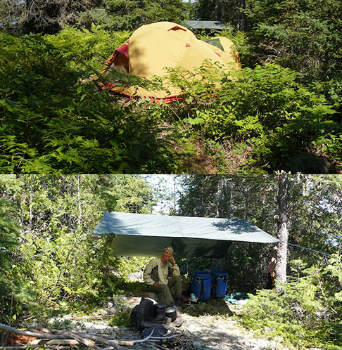
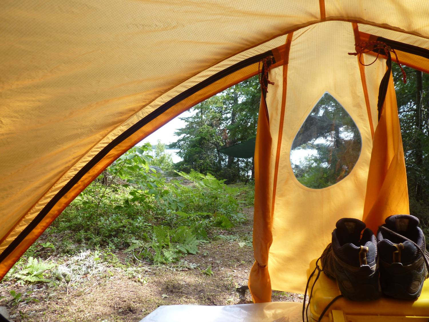
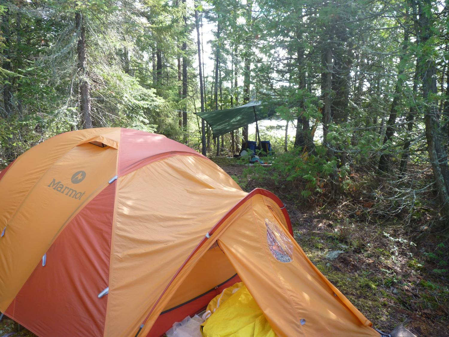
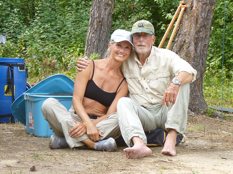
Our Project
Why do this?

We really set out on this project for more selfish than altruistic reasons.
Over the years we've watched the roads in the area gradually close in so that access to places we used to be able to drive to are now not reachable by road unless you've got an ATV.
All the old portages have gradually disappeared leaving only the faintest traces of where they used to be so that travel for us was getting very difficult.
This is one of our favourite places ... we want to be able to continue using it ... and we're not getting any younger so the portages need to be in better shape.
In 2008, as we recreated the circle trip from 1978, we had a long discussion as we sat on Rush Lake after struggling for two days to get down the Opeepeesway and Woman Rivers and up the Rush River.
The portages were either gone or in terrible shape and if we wanted to continue to use the area we had to take it on ourselves to improve the situation or we'd not be able to get through in the future.
What we've accomplished
2008
After our discussion in 2008 we retraced our steps to the outlet of Rush Lake and cleared the portages from Rush Lake down to the Rush River and to the Woman River.
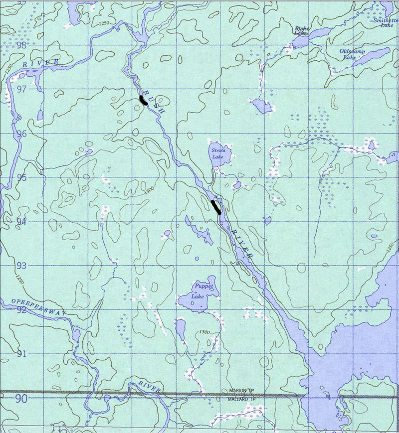
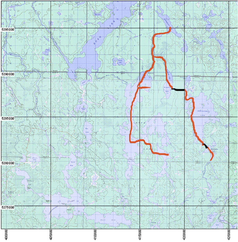
To see the map of the Rush River portages ...
Rush River portages
2008 also saw us mark and open up the portages from Rush Lake to Rice Lake just enough so that we could get through ... leaving the final touches for another time ... remember, this is our vacation time so we don't want to spend it all finding and clearing portages.
As it turned out 2008 was a good year for this initial effort. Since the water was high that year it forced us to look for portages where in the past we'd waded and dragged the canoe up sections of the river.
We succeeded in locating all the old portages that I'd remembered from 1978 ... all the trail markings were gone but there was still evidence of a trail if we looked closely at the ground.
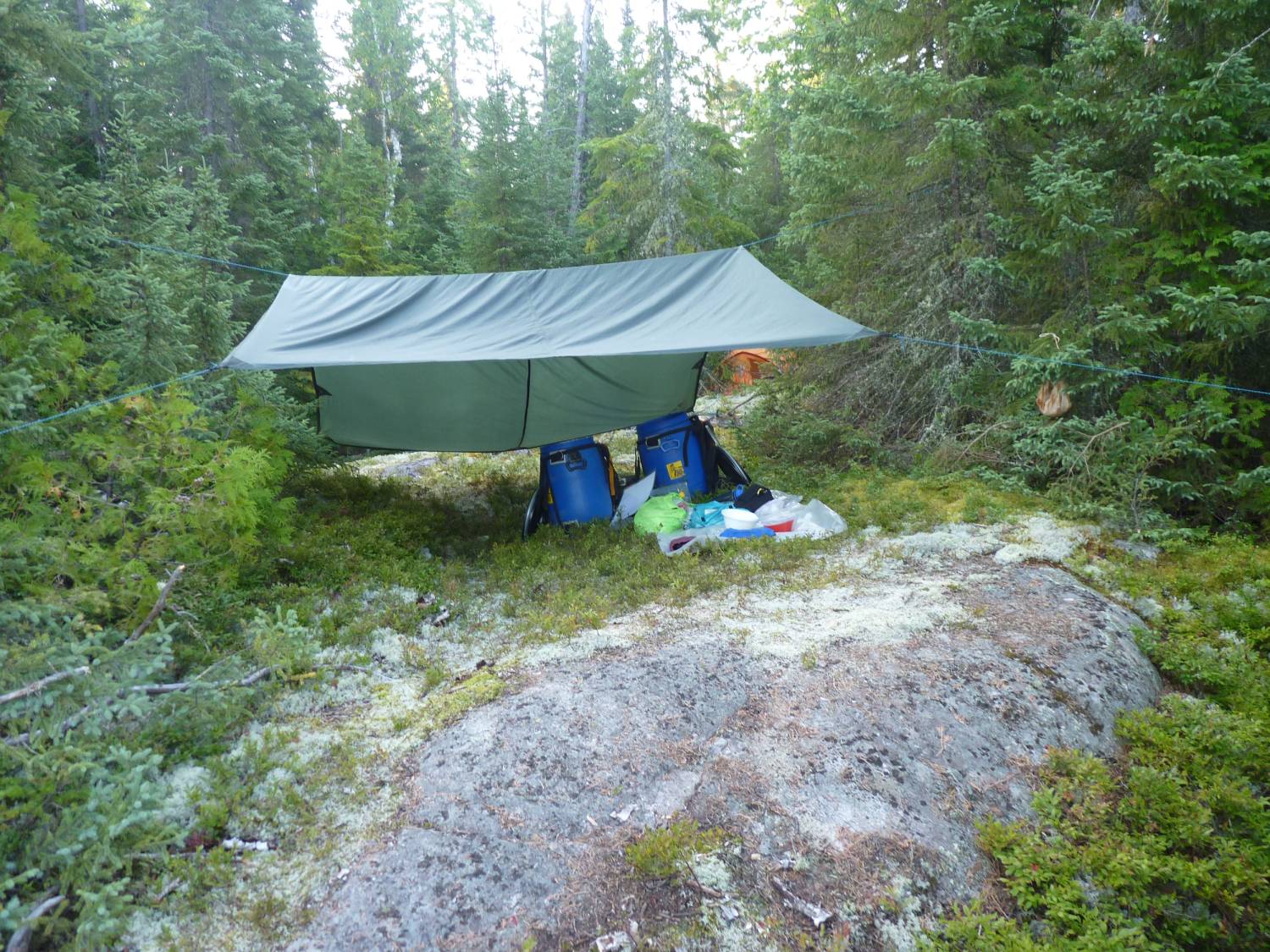
We explored each portage to its end ... installed flagging tape ... and cleared just enough so that we could get through.
A trip up the Rice River that now takes about 5 hours took us 12 hours that day ... and because of all the high water the bugs were bad that year ... we were a mess by the time we got to Rice Lake.
To see the map of the Rice River portages ...
Rice River portages
We also explored the south end of Rice Lake and located an ATV trail which led west to a road ... by following that road to the south and then exploring a branch to the west we were able to overlook Little Rice Lake ... the total road distance from Rice to the overlook was about 2 km.
We did walk down to the shore of Little Rice but the area had been logged and it was a tangle of downed trees and raspberry canes ... there was no visible path that could be used as a portage.
To see the road setup ....
Rice Lake South roads
Notice that the road on the map is in red ... there are signs at the south end of the road where it leaves the Sultan Road warning that the road may not be used to access Rice Lake ... therefore if you want to get to Rice Lake you will have to approach from either Rush Lake or Little Rice Lake.
2009
We returned and completed the marking and clearing of the portages from Rush to Rice Lakes.
There are five portages along the Rice river from Rush Lake to Rice Lake.
The first is on the right just after a small swift that can be paddled up in all but very high water ... it's about 250 meters ... the landing is rockey but the put-in is grassy.
The remaining portages are all on the left ...
The next is a short 75 meter carry around a small drop ... we call this the bed frame portage because of the presence of an old iron bed frame along the path ...
To see the bed frame...
We'd love to know how this got here ... who brought it ... and when. It must have been part of a trappers line and served as a layover point. In the late 70's there was a house on Arbutus Lake and a cabin on Little Rice. The house is gone and the cabin has collapsed. These, and evidence of other old campsites in the area, must have been the domain of a trapper.
The third portage is the longest of the series at about 600 meters.
The fourth, which starts with a small uphill section, is about 250 meters in length.
The final carry is around a ledge and encompasses 100 meters.
Just upstream from here is the outflow of Rice Lake which can be paddled up in all but very high water levels.
In the late 80's we would wade and drag the canoe up and down the first, third and fourth obstacles. The river was kept open by the trapper. At this point the only the fourth can be waded due to trees across the river.
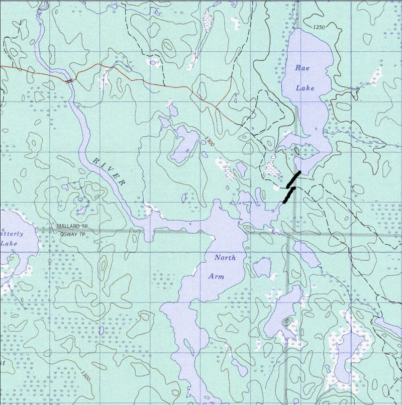
With the Rice river portages completed we moved over to Opeepeesway Lake to begin the search for the portage to Rae Lake.
With the road to Rush Lake closed in to all but ATV traffic we need an easier path to Rush Lake if we're to visit there in the future ... this year we drove up the Rush Lake road as far as a trappers cabin on Mallard Lake to get access but that road is also closing in and I would not recommend it to anyone without a four wheel drive vehicle .... and plan to get your vehicle scratched up from the overhanging brush.
It didn't take us long to find the beginning of the old portage and we followed it for about 200 meters before it led into a big blowdown area ... but at least we know its here so we'll come back next year to clear it.
2010
Boy did we ever work this year.
We arrived at the road to the Opeepeesway River bridge to find a notice that the bridge was to be removed and rebuilt so we were not to cross the bridge.
This put a bit of a crimp in our plans because we were planning to try to find the portage from the road that crosses the bridge and then passes between Opeepeesway and Rae Lakes.
We'd seen the portage many years ago ... probably around the mid 80's ... so we thought that we could find it from the road ... but it was not to be.
We arrived at the bridge to find some people camped there and they told us that the repair crew had been there and informed them that they'd be back today to start the construction.
Sure enough ... as we were almost unloaded the crew arrived.
The construction project would begin tomorrow and would take about a month to complete. When asked if there were plans to begin logging in the area again they had no inkling ... but why would the bridge get rebuilt unless it was to be used for the passage of logging trucks?
If the road does get rebuilt I'm betting that signs like the ones at the road to Rice Lake go up ... after all, the same fly-in service owns the camps on both Rice and Rush lakes ... so now it's more important than ever to get that portage from Opeepeesway to Rae completed.
We setup camp on Opeepeesway Lake near the portage we found last year but the water was really low in 2010 so we couldn't paddle up to the portage ... we had to pull out about 150 meters from the actual portage and bushwack our way over to the start.
We followed the portage for the first 250 meters or so before we lost it in a blowdown.
Taking a bearing and marking our trail with flaging tape we worked our way out to the road ... now to find the continuation to Rae Lake.
A few circles through the bush on the north side of the road produced no results so we took a bearing to Rae Lake to see if we could find it there
Arriving on Rae Lake we traversed the south shore and it didn't take us long to find the trail ... so up through the bush we went marking our way.
A little searching and our markers to the Opeepeesway trail were visible ... by the time we got to the south end of the trail we'd used up a whole day ... now we needed to straighten the trail a bit and begin clearing it.
The Rae Lake side was very obvious so we decided to clear it first ... it also gave us a chance to walk the Opeepeesway side a few times to see if we needed to make any modifications.
It took us a day to clear the Rae Lake portion but we had to leave four or five fallen trees that were over a foot in diameter because our handsaw was not big enough to tackle them ... so if any of you want to take a chainsaw and finish clearing the trail it would be easy to get a 14 foot boat down to Rae Lake ... and I don't know when it got fished last.
It took us three more days to finish the Opeepeesway side of the trail by the time we adjusted the trail and cleared small sections at a time ... but we did finish it.
By the way, we did brush out a bit of a trail from our landing spot to the portage in case anyone arrives in low water conditions.
To see the portages ...
The trails are well marked at the road so if you approach from there you should not be able to miss the flagging tape.
The distance from the bridge to the Opeepeesway to Rae portage is 6km or 3.7 miles.
We'll return in 2011 to see if we can find our way through Little Rice Lake to Rice Lake.
We've heard that the traditional portage is gone but that there is a snowmobile trail that we might be able to use.
2011
We returned in August to begin the quest for the portage from Little Rice to Rice Lake.
We first drove up the New Arbutus Road to see what conditions were like there.
Arriving at the bridge that spans the outlet of Stony Lake we noticed that the road beyond there was closing in rapidly. However, we heard that someone had been working on the old portage from Stony to Arbutus so we wanted to check it out.
After some searching we did find some flagging tape and followed it to what might be a put in but the trail needs a lot of work before it is ready for prime time.
We'd hoped to be able to start here but after some looking around and a short discussion we decided to forego the clearing of this trail and instead start at the bridge over the Opeepeesway River.
The new bridge is a thing to behold ... it's well done and should last for the next 50 years.
Crossing the bridge we continued east on the road to check on our trail markers ... and sure enough they're still there.
Putting in at the bridge we paddled out onto Opeepeesway Lake and camped for the night.
The next day we paddled to the far eastern end of Opeepeesway Lake where there's a nice campsite with a great sand beach. Swimming here is nice as the sand extends out into the lake. This is the only place on the east end of the lake that is not rocky and slippery.
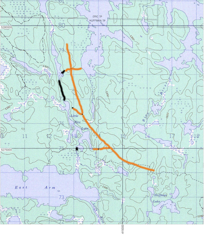
We next took an exploratory trip up to Little Rice and paddled to the northeast arm to look for the portage where I remembered it from 1978. In two hours of thrashing around in the bush we found the snowmobile trail that leads north to an unnamed lake and the old trappers trail with the same destination. We left the exploration of these trails for another day and returned to our campsite.
There's a beaver dam and a short portage ... 60 meters ... to get to Little Rice Lake.
Armed with the knowledge of the snowmobile trail we moved our base to Little Rice. There's only a couple of places to camp here. One at the middle of the lake might hold two tents.
I really wanted to find the old portage so we spent another couple of hours and actually found a few blazes but the trail soon petered out so we walked the snowmobile trail north to the unnamed lake. The trail is in pretty good shape but it's constructed through the low ground leaving it boggy and muddy in sections. But hey ... we're halfway there.
Before carrying all our stuff over to the unnamed lake we decided to go back down Little Rice to the southeast bay where we saw a boat pulled up into the bush. we figured that there must be a trail up to the logging road and from there we could walk north to see if we could find the missing link to Rice Lake.
We took our GPS so that we could mark some waypoints and we took some flagging tape to mark the intersections we were sure we'd find.
It took about three hours but we walked up to the ATV trail into Rice Lake and explored the side roads ... and guess what? ... We found the other end of the snowmobile trail!!! It was right where it should have been.
Following the trail down to the unnamed lake, we could see that we only needed to paddle about 500 meters to connect the two portages.
To see Little Rice trails and roads ...
So here's the skinny .... The portages from Little Rice to Rice total about 2100 meters. The first is about 1000 meters and mostly boggy going but it's flat and we were able to avoid getting too muddy. The second section ... from the unnamed lake to Rice Lake ... starts up through rocky going and meets a road. From there down to Rice Lake is over an ATV trail. The Rice Lake end is very swampy and chewed up so we'd advise carrying a light load first so that you can plan your route through this quagmire.
If you want to try to use a cart the trail from the southeast end of Little Rice is a possibility. As is the road that comes within about 200 meters of the lake at its north end ... but this will involve bushwacking up the hill to the road. I'd try walking either of these a little bit to be sure that they're open.
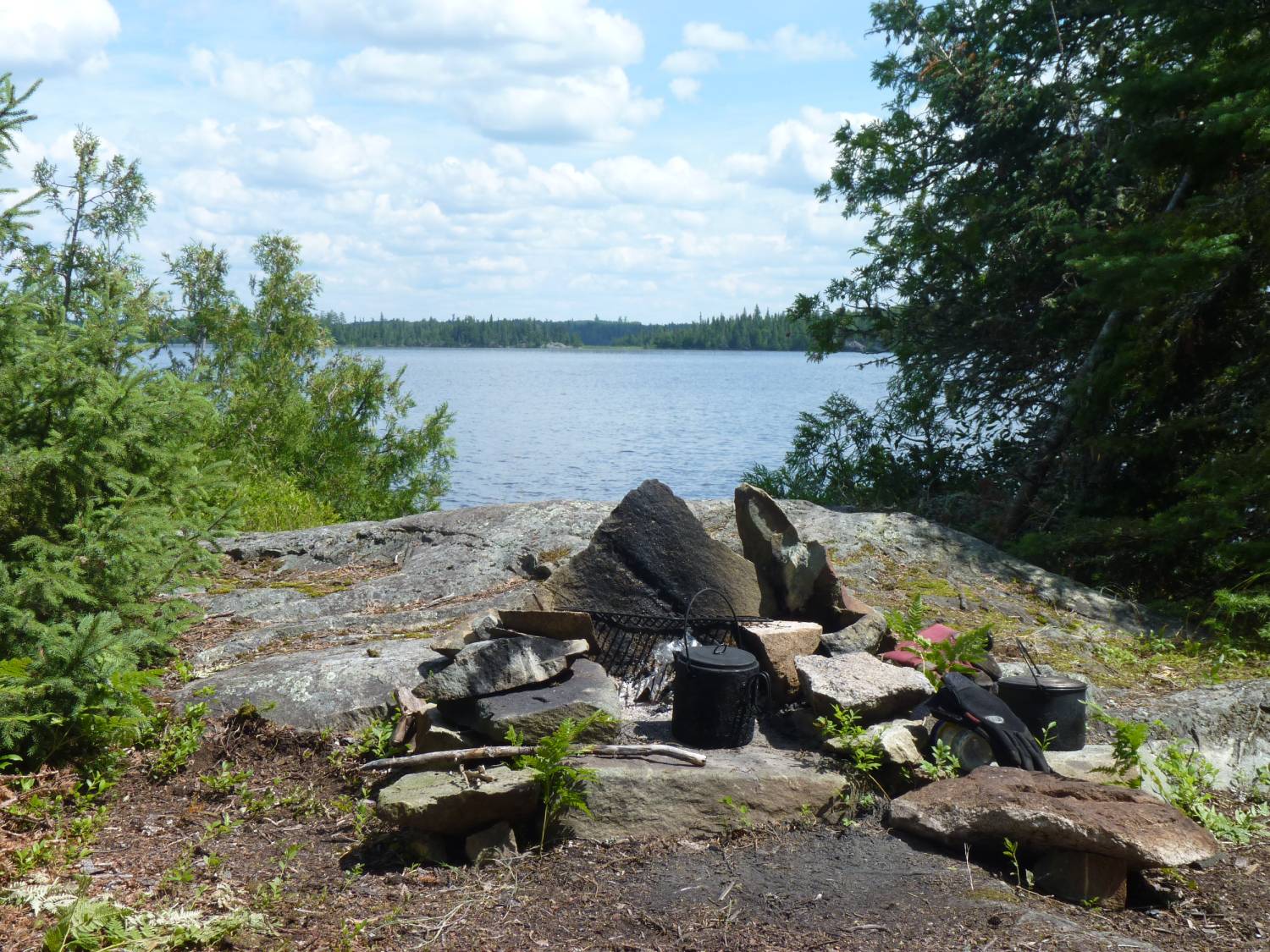
Of course we went over to Rice Lake. There are still some possible campsites on the islands at the south end of the lake but we prefer to be around the narrows and there's a spot there.
and the fishin's still good ...
Picking a nice sunny day with hardly any breeze, we took a day trip up to Northpoint Lake.
There's an old fly-in camp there that doesn't get used anymore ... we met people who were staying there in about 2004 and at that time they reported that the pike fishing in Northpoint was really good.
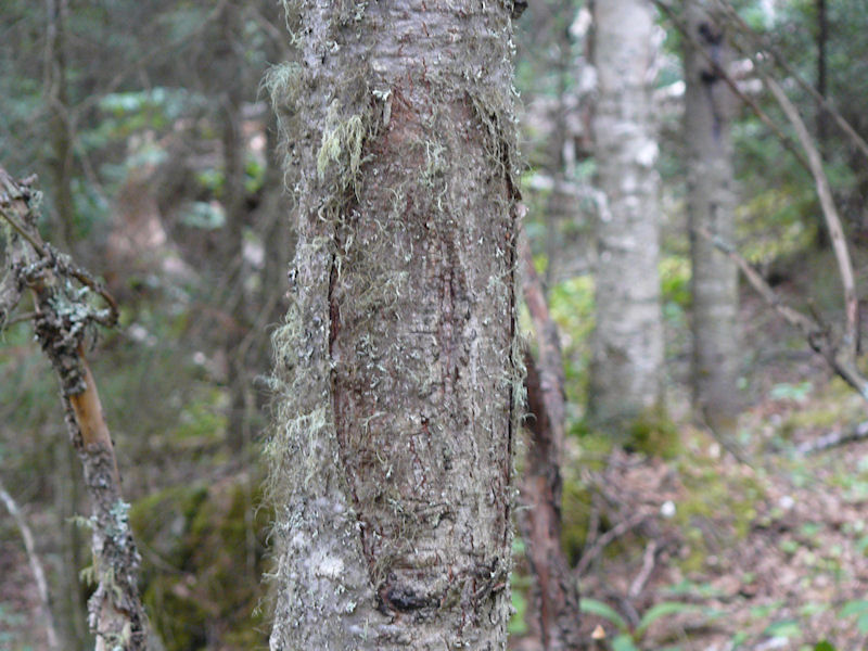
Returning to Little Rice we decided to have one more look for the old portage ... and lo and behold we found it!!
a pretty obscure blaze ...
We followed the old blazes for about 300 meters before we took a look at each other and said ... "Even if we mark this trail who will ever come along and clear it?"
We'd be happy to go back and mark the trail if anyone will volunteer to clear it. Near Little Rice will require a bit of cutting but the trail passes through mature forest for the next 200 meters ... only about 1000 meters to go ... and that involves crossing the road since the old landing on Rice Lake was about 200 meters south of the current ATV trail.
Anybody game?
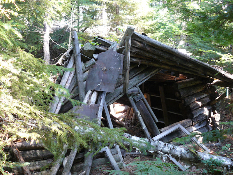
I also went to look for the old trappers cabin that I remembered from 1978.
In 1978 this was standing and active ...
I think we'll come back in 2012 and do the complete circle.
We'll probably start at either the bridge over the Opeepeesway River or at Arbutus Lake and travel up through Rae Lake first. Our reasoning is that if water levels are low we'd rather find out at the beginning that the passage from Rae to Mallard is almost impassable.
2013 - July
So much for the promise to return in 2012
Instead we spent our time in Quebec canoeing on Kipawa Lake ... a beautiful but busier place ... but now we're back.
We came back in July and did the loop from the bridge over the Opeepeesway river up through Rae, Mallard and Marion to Rush then up the Rice River to Rice Lake ... up to Northpoint Lake and back to Rice ... south on Rice and over to Little Rice ... back to the east end of Opeepeesway ... then up to the north end of Opeepeesway to end our trip.
We started the trip on July 13 ... during a heat wave ... and the bugs were really cooking.
After driving through the night and having breakfast at the Watershed we put in at the Bridge over the outlet of Opeepeesway Lake and paddled to the mouth of the northeast bay before camping for the night.
We'd had a lot of rain this year so the water levels were quite high. High enough to paddle right up to the portage leaving Opeepeesway Lake for Rae Lake the next morning.
The portage was easy enough to follow but it looks as if it has not been used.
We cleared away some brush on either side of the road, did some minor clearing along the trail and re-tagged the route before completing the carry to Rae Lake.
By the time we got to Rae Lake I looked like Pigpen from the cartoon section with the cloud of bugs around me. I was wearing gloves but the mosquitos were biting right through the backs of them to say nothing of the shirt that was sweat plastered to my torso ... the temperature was 29 Celsius.
The breeze was from the south as we traveled up through Rae Lake to Mallard and Marion Lakes and finally out to Rush Lake where we camped on that first night.
The five portages from Rush to Rice were easy to find and thankfully only required some minor clearing and re-tagging since it was still hot and the bugs were out in full force.
The portages look to have not been used very much if at all.
We ventured up to Northpoint Lake and stayed there for a night but the bugs were bad here so we left the next morning and returned to Rice Lake.
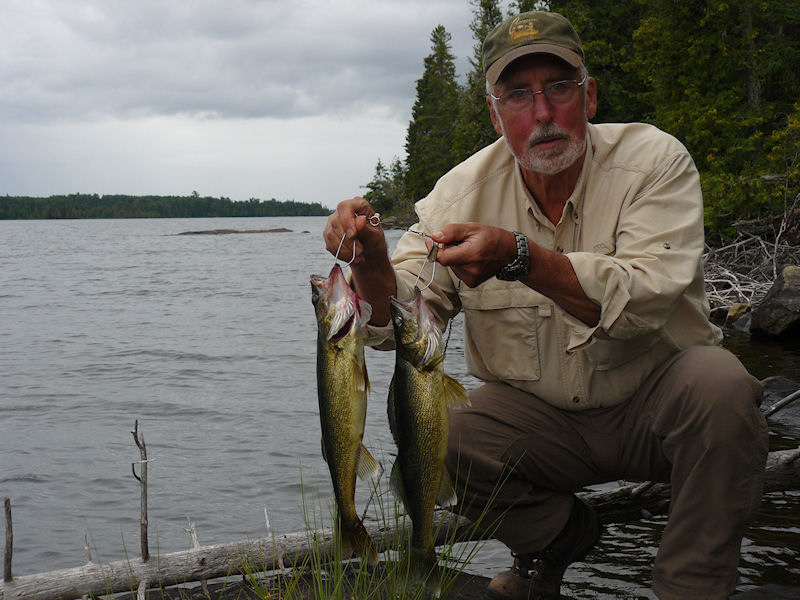
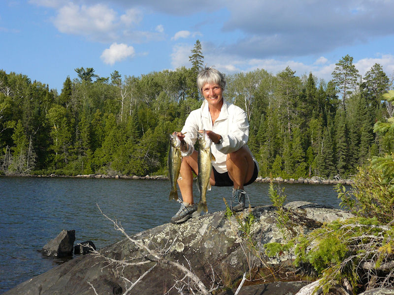
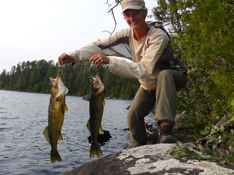
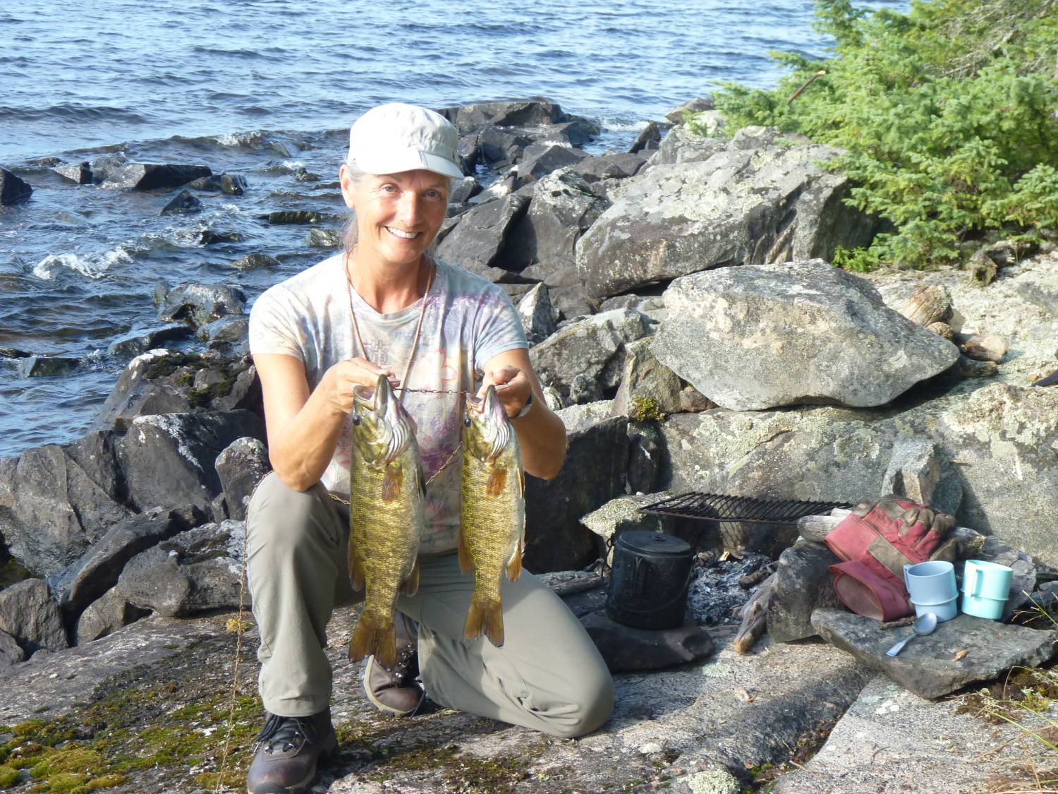
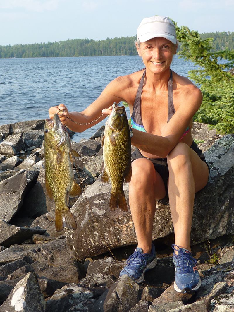
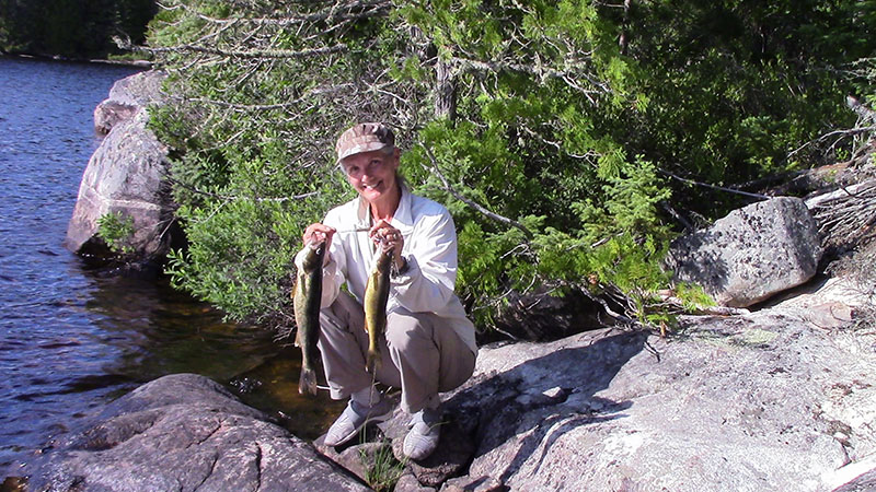
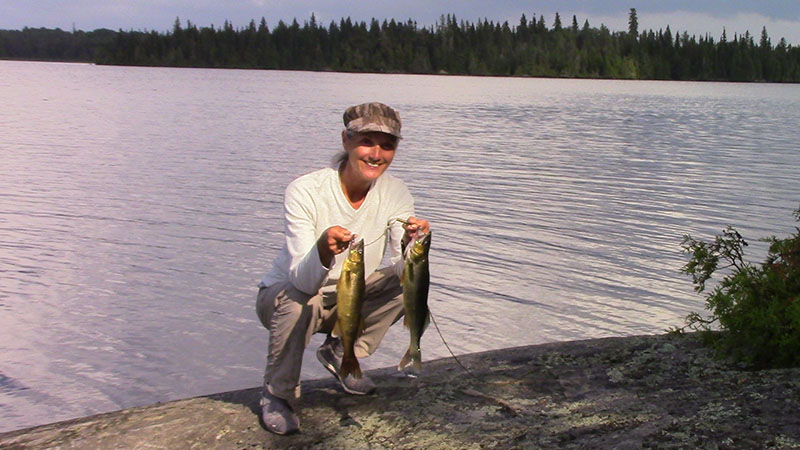
Our stay on Rice Lake was punctuated with a lot of swimming to get cooled off and a fair amount of fishing ... for evidence of our luck ...
Walleye of 16 and 20 inches ...
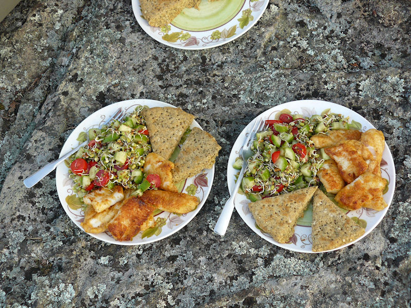
These we had for dinner with a sprout salad and pesto bisquits ...
Rice Lake Gourmet Dinner ...
If you haven't tried sprouting on longer trips it's a fairly easy process only requiring some muslin bags, some sprouting seeds and some potable water. Check with your local health food store for the seeds. The process tales us about four days from the initial soaking of the beans and seeds until they're ready for consumption as sprouts.
We left through the south end of Rice and did the three portages necessary to get out to the east end of Opeepeesway Lake.
The portage from the unnamed pond to Little Rice Lake was wet and a little tough going in places but these trails are well used by snowmobilers so they are pretty clear.
We lucked out and got a really nice day to paddle up to the north end of Opeepeesway Lake. Almost no wind and a cooler day.
A rest and clean up day and we're ready to rejoin civilization
We're planning to go back on August 10 through 24 to put in a little more time on one of our favourite haunts ... and hopefully get in a little more fishing ... and a little fewer bug bites.
If you've never visited this area it's pretty easy to get around ... and the walleye fishing is the best we've encountered in mid-Ontario.
So come on folks ... the area needs to be traveled to keep the portages open ... and I'm not getting any younger.
By the way, we've never encountered another canoe party in all our years of canoeing this area.
2013 - August
As promised we returned from Aug 10 to 24.
This time we started at Mallard Lake ... you can drive to Mallard if you've got a four wheel drive and don't mind a few scratches.
Access to Mallard Lake ...
Launching on Mallard at about 10am and were on Rice by 5pm ... the portages on the Rice river were clear and dry.
Spent a few days on Rice before heading up to Northpoint.
As we paddled up the Northpoint River we decided to try to get to Wenakoshi since the water was up this year ... after about an hour of stream work and two small beaver dams we were on Wenakoshi.
Looks like nobody has been here in a few years.
About a third of the way down the west shore we spotted a washed up dock and some old cribbing. Further investigation revealed a clearing and a burned out cabin.
There's a fern bed here and a good place to setup our tarp so we decide it's home ..
Wenakoshi Campsite ...
The tent is a little too exposed for our liking so we'll try to find a better spot on our next visit.
We spend several hours over the next two days gathering up the trash that's here ... burning what we can and hiding the rest.
After a pot of coffee we decided to test our luck fishing ... my first six casts yielded 5 pike ... all of about the two to three pound variety.
We fished for about two hours and continued to haul in the pike.
Now we were loosing lures ... jigs mostly ... since we only had 8 pound line and no leaders available.
I rigged up some leaders out of some 20 pound line we had along ... we continued to loose lures ...
The biggest pike we landed was about 5 pounds.
All of this was just casting from shore off the rocky point in front of our site.
We gave up and came back after dinner ... just at dusk ... and continued to loose lures.
If you want some arm tiring action on medium sized pike this is the place for you ... and I guarantee that you'll have the place to yourself ... the fly-in guys from Rice Lake can't get here.
We did get up to Northpoint and spent three days there before returning to Rice and paddling back down the Rice River and out to Mallard Lake.
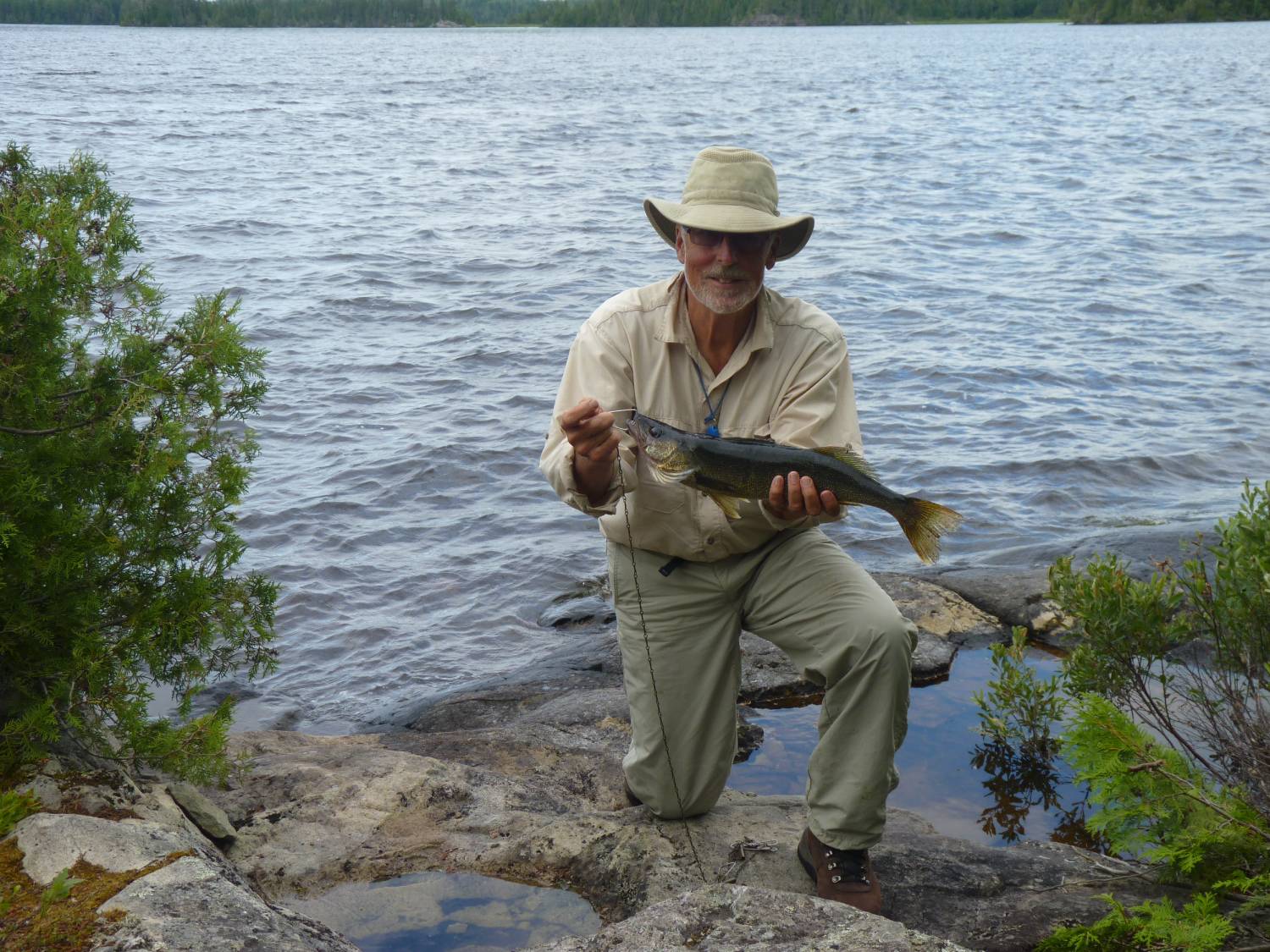
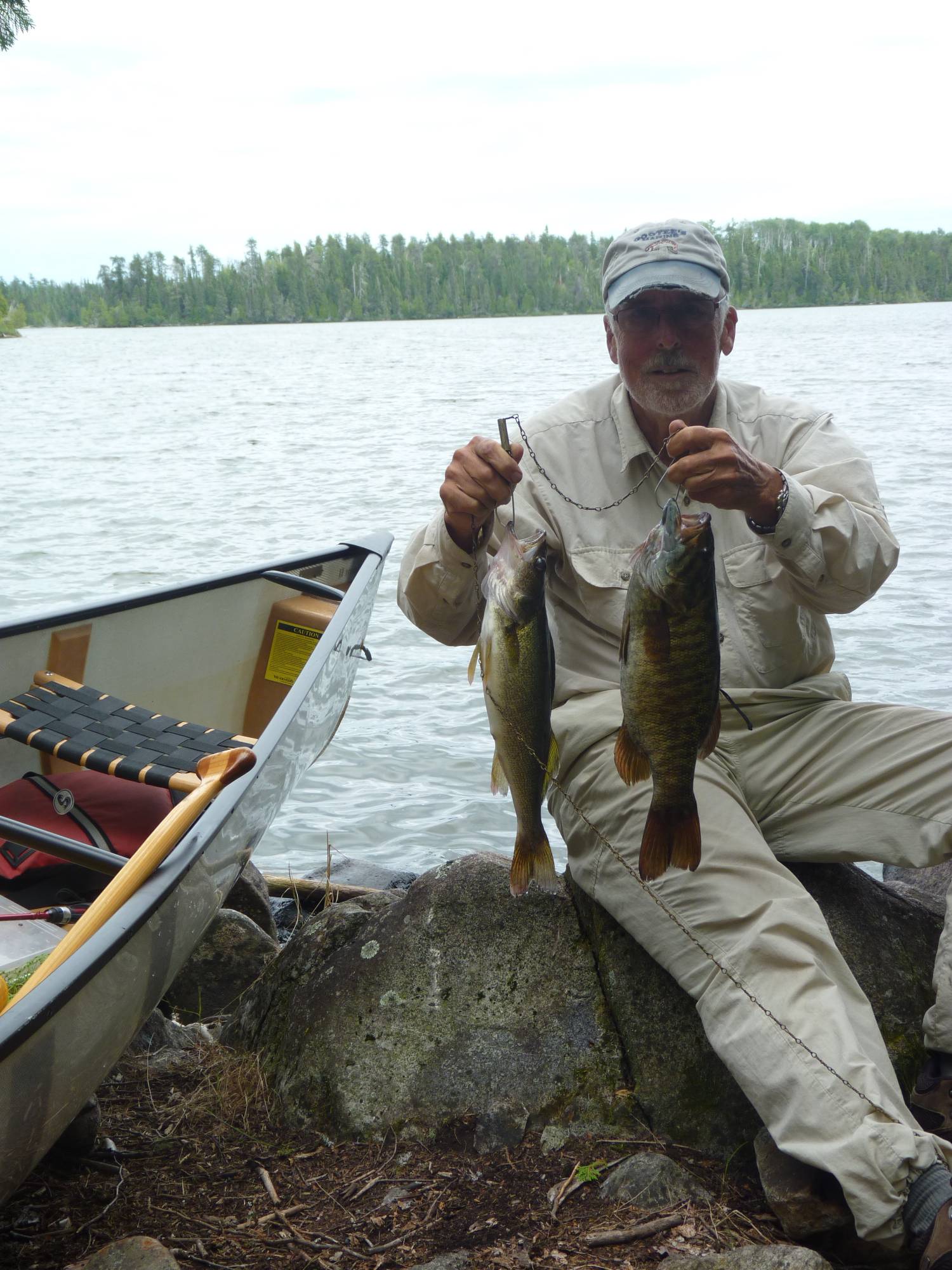
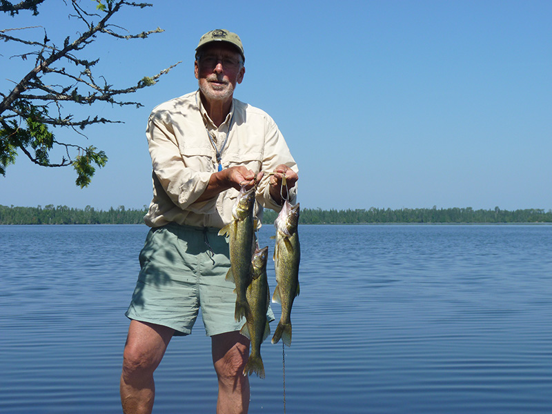
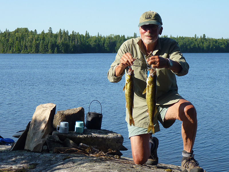
If you are a walleye fisherman here's evidence that the fishing in the area is pretty good.
Back on Rice Lake we caught these beauties ... a 24 and a 26 inch ... a quick picture and then we released them ...
A productive afternoon on Rice Lake ...
We could have had fish almost every night had we wanted to ... I think that there were only two days that we didn't catch any keepers.
On the way down the Rice River we made sure that all the portages were well marked at both ends ... The trip out from Rice to our truck on Mallard only took us six hours.
So come on folks ... whaddaya waitin' for?
2014 - July 10 to August 21
That's right, 42 days ... and we covered a lot of territory.
You may remember that the summer of 2014 was not the best ... as a matter of fact our 42 days saw mostly rainy days with wind from the north ... Hudson Bay lowland kind of systems ... cool and misty ... with the odd three day wind and rainy spell. Bugs were bad at the start and moderated to tolerable by the end. However, evening fishing was out of the question as we scampered to the tent just after sundown.
The trip was divided into three fourteen day segments ... the first was to take us from the bridge south through Opeepeesway Lake to Arbutus and on to Stoney, Potier and Windy.
The second leg would take us up through Mallard to Rush ... over to Rice and north to Northpoint and over to Wenakoshi.
Once on Wenakoshi we hoped to explore the area between Wenakoshi and Pebonishewi with the goal of marking and clearing a portage to cover the 1.6 km and allow us to get to Pebonishewi ... a lake that we originaly tried to reach from the south in the late 80's.
The final leg would see us traversing the Rice river again and portaging to Pebonishewi for a few days before returning to Rice and Rush as we made our way back to Mallard and out.
This was to be a more leisurely trip ... other than building a 1.6 km portage and getting to Pebonishewi ... we just wanted to visit some of our old haunts and explore some new territory with the plan to investigate some new places to camp and possibly build some new campsites.
Segment one: July 10 to 21.
After a 6am breakfast in Cartier at the Pine Grove we arrived at the bridge around nine and were on the water a little after ten ... we camped on Opeepeesway Lake at the entrance to the northeast bay. This is a marshy section of the lake so the bugs were pretty bad ... even our exposed point didn't keep them at bay.
We awoke to a bright sky as the sun was about to rise. There was only a slight breeze so it was a good day to begin our trip to the east end of Opeepeesway Lake.
There are a dirth of decent campsites on the way ... all islands have been overused and/or trashed by spring fishermen ... so we wanted to see if we couldn't establish a site near the narrows at the entrance to the east end.
We woke to the constant drone of mosquitos under the fly but it had the promise of a sunny day.
It was indeed a nice day as we paddled south. We wanted to see if we could find or build a campsite at the narrows leading to the east end of the lake. The fishing around here is good but it's a long paddle from any established campsite on the east arm.
There are a couple of places to camp just inside the north arm that we stop to have a look at but this is not where we want to be so we put one of them on our list to stop at on the way back and continue on.
As we've reported previously, the islands on Opeepeesway have been overused by spring fishermen so we don't even stop to look at the couple we pass.
At the narrows there's nothing appealing but we still disembark to have a look.
Continuing along the south shore there's a rock shelf that slopes gently into the water so we check it out … it's not ideal … there's no good place to swim and the possible tent site is pretty small but we decide to make some improvements.
A couple of hours later and we're all set up. We decide to stay another day to really break the place in and to try the fishing. We did get out fishing with no great luck. Kathy caught a couple of keepers just off the front of the site but by now the wind was up from the north and it was turning colder so I found a sheltered spot to cook our hamburger helper dinner.
The next day was a continuation of the wind and showers … wind now from the northwest.
Some fishermen stopped by to see us … one guy reports that he's been fishing here for 40 years … his dad had a cabin on the lake and he continues to return whenever he can … they weren't having any luck.
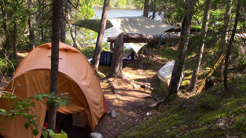
Arbutus Lake is not far from here … only three portages … and I know there's a campsite on the mid-lake island … I'd camped here in the early 80's, moose hunted here in 1984 (at that time there was an abandoned house in the bay heading west … we setup our moose camp there) and we passed the island in 2008 … so we head there the next day.
The portages are in decent shape so the trip is fairly easy. The island is more bare than I remember but there's a built-in table and a firepit that I can rearrange to my liking.
Arbutus Campsite ...
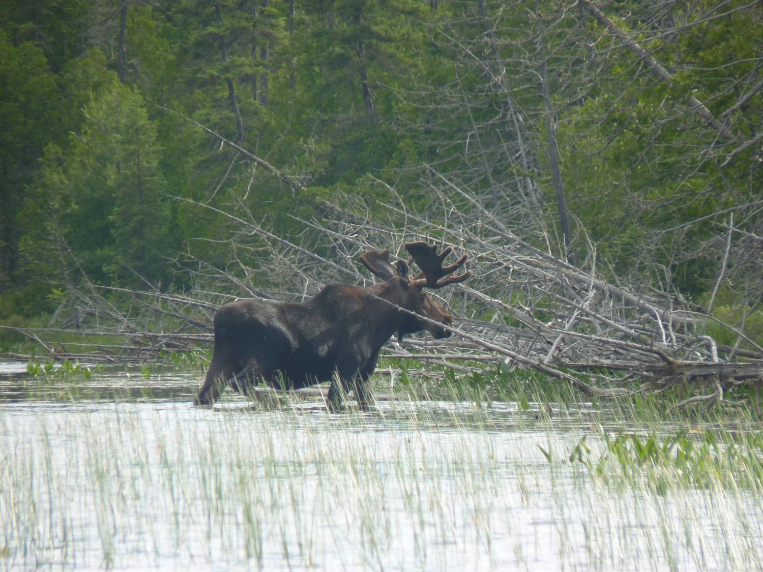
We spend a day paddling around Arbutus and doing some unrewarding fishing … the old house is not only gone, but there's absolutely no trace of it … here's the guy that I was looking for in 1984.
Nice bull moose ...
After a rainy and windy day we explore the southern end of the lake to find the old portage to Stony Lake. At the end of the lake there's a narrow rock filled section which will require portaging … even though the water is high there's not enough in this channel to float a canoe. The absence of a portage here is not a good sign but we continue on by carrying the canoe up the bank for the 70 meters or so to the next paddleable section.
Another 200 meters and there's a marker on the east shore so we pull over to check it out. A path leaves here along the river but soon veers left and heads up toward the road … we follow and sure enough it comes out at the road but leaves us 600 meters from the bridge at the outlet of Stony Lake.
We had hoped for a more direct path that would have put us within 100 meters of the bridge so we retrace our steps and make our way back to our island home.
It doesn't take much discussion to convince us that we don't want to follow the route we just explored … it was buggy and involved as much work as using the ATV path from Arbutus up to the road and then the 1000 meters to Stony. We decide to leave Stony and Potier to the end of our trip and drive in if we have time.
So it's back to Opeepeesway on a damp and dreary day punctuated by fog and showers.
The next day is clear and sunny but not very warm … Kathy does a wash and we dry and reorganize our gear.
Rainy, windy and cold are the earmarks of the next two days and since we have time we stay put.
On the third day they arose to a clearing sky and light breezes so it's off to the narrows toward the north end of Opeepeesway.
We arrive at the campsite we explored earlier and began the cleanup process … this is a low-lying area with a big marsh behind the site so we expect it to be buggy. The cleanup takes a while to round up the trash left by the spring fishermen but the stuff makes a good smudge fire and keeps the bugs at bay.
We go for a swim and a bath then try our luck fishing from both the shore and the canoe … only takers are pike … one good sized … we release it too.
A moose visits the marsh late in the day but we can't stay out to watch because we're getting eaten alive.
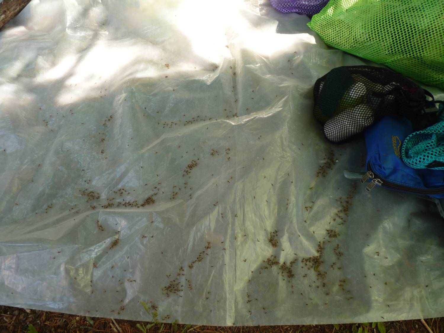
The bugs are really out overnight so I wait until after sunrise to get started … even a smoky fire does not seem to deter them … at one point I decide to stand my ground under the tarp and see if I can make a dent in the population … I'm killing several with every swat but after 15 minutes I'm getting nowhere … here's pictorial evidence of the bodies that fell on a sheet of plastic we keep under the tarp to place our foodstuff on.
15 minutes of swatting ...
We return to the bridge and drive over to Mallard Lake to conclude the first segment.
Segment two: July 22 to August 2.
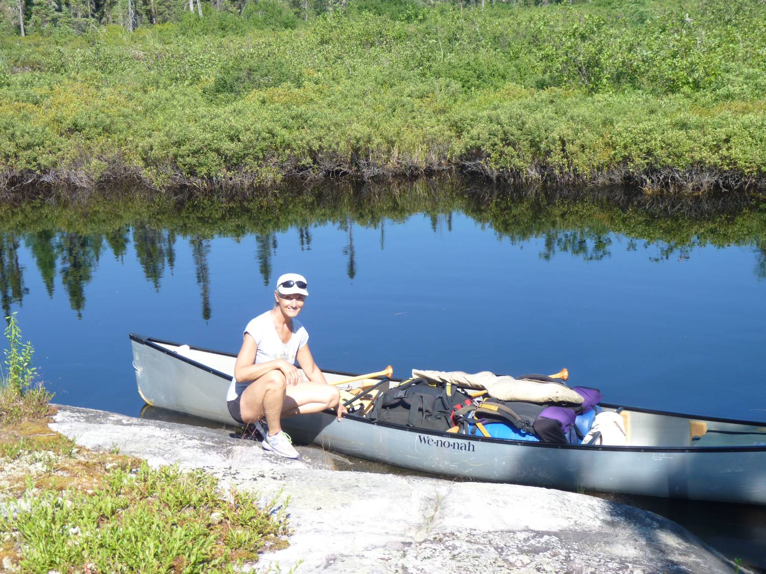
The first day is a little hectic as we leave Opeepeesway ... load the truck ... drive over to Mallard Lake ... organize our supplies for this segment ... and paddle up through Mallard and Marion to Rush where we camp on a spot we've used since the late 80's.
After a rest day we paddle up the Rice River and after the five portages ... which were in good shape and which we cleared a little more since we'd be back this way ... and camp at the north end of Rice Lake.
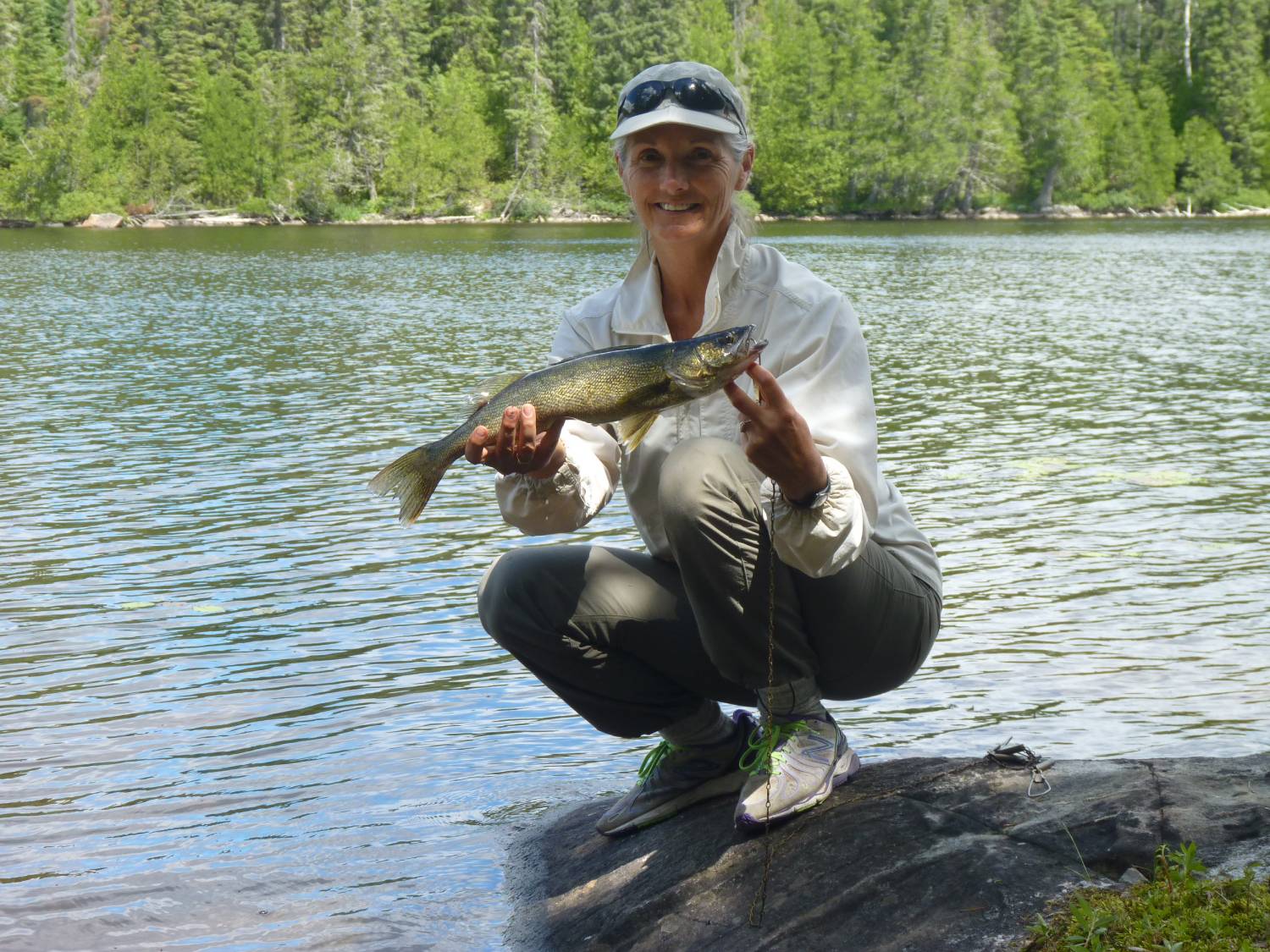
Knowing that we've got a lot of work ahead of us we move to Wenakoshi and spend a day revamping the campsite and doing some fishing. This place is full of small pike but Kathy catches one that's eating size.
One decent pike ...
The next day dawns cloudy, warm and very humid. Looks like showers but we decide to try marking a trail over to Pebonishewi. We've consulted the map and decide that the shortest path will start down the lake behind the third island and go directly east for about 1.6km.
The landing spot is a little rough but we clear enough to get the canoe up to safety and start out ... clearing just enough to see our back path ... and installing trail marking tape at strategic intervals.
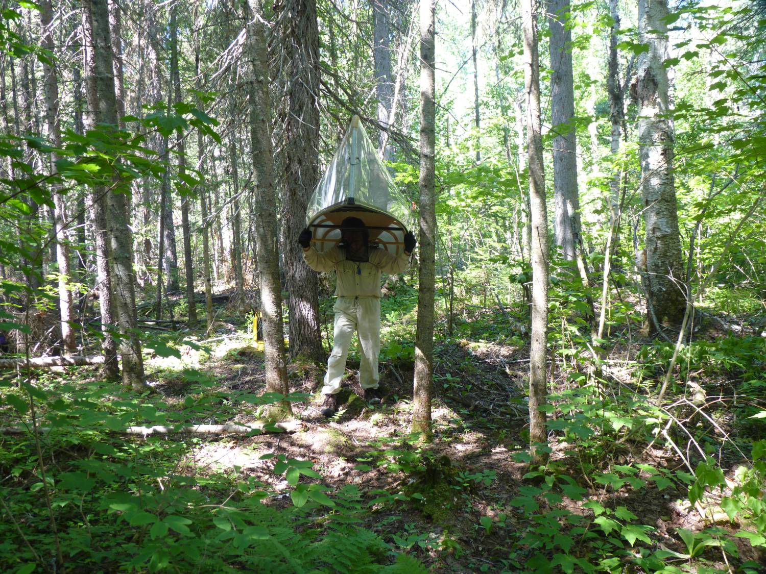
It doesn't take long for me to turn into a sweat soaked version of PigPen, including the cloud of bugs that hound me all the way across.
We finally emerge on the shore of Pebonishewi at a floating bog but it supports us all the way to waters edge.
We made the mistake of not bringing any water with us so we had to retrace our path ... and that took another hour.
By the time we got back to the canoe I was exhausted ... I'd had it with the humid conditions and the bugs.
When we got back to the campsite I told Kathy that there's no way I'm going to clear that portage and carry our stuff over to Pebonishewi only to spend a few days there and come back. Would I try it again in the future? I don't know ... but I do know that I'm not doing it now.
This puts a cloud over our next few days since we've got to rethink our schedule and get our minds around the fact that we'll not be getting to Pebonishewi anytime soon as well as the fact that we wanted to stay out for 42 days.
We spent the next day at our campsite getting rehydrated and considering our options. We still had eight days left in this segment before our planned trip back to Mallard Lake for resupply.
So its off to Northpoint to lick my wounds and spend a couple of days relaxing, swimming and fishing. The nice thing about Northpoint at this time of the year is that Ivanhoe Air does not operate its camp here. They only run it during May and June so we're completely alone here ... and the fishing was good.
Northpoint walleye ...
Our plan now is to execute our resupply and return to Rice Lake where we'll explore the southeast portion of the lake and establish at least one good campsite for future visits so its down to Rice north for a couple of days and out to Mallard for our resupply.
The resupply day is a long one as we travel down the Rice River and across the five portages and then tackle the marshy areas down through Marion to get to Mallard. Once on Mallard sort out the food and gear we'll need for the next segment, reload our barrels and paddle back north to Rush Lake.
Segment three: August 3 to 18
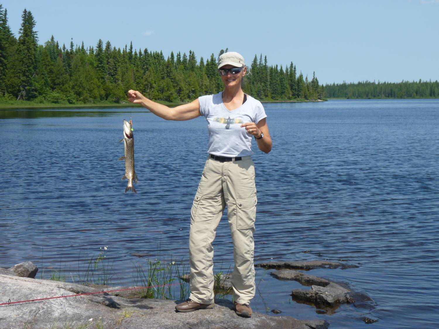
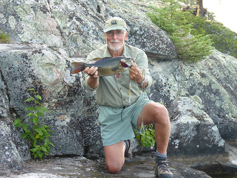
So we spend a couple of days on Rush ... and it was worth it ... weather was better and the fishing was good. When I first encountered Rush Lake in 1976 it was loaded with good sized pike but over the years the walleye have taken over the lake so that they are now the predominant species.
Rush Lake walleye ...
I'm getting tired of the Rice River and its five portages but at least we're keeping it open and its only about six hours from Rush to our spot on Rice north.
A day of rest and we head south and through the narrows to the east ... we're headed for a spot that I remember from our trip here in the late 90's ... a shelf all the way on the east side that I thought at the time would make a good campsite.
It doesn't look quite as I remember but after a little consideration we decide to setup here. The site slopes up away from the lake then dips down so we place the tent just over the rise and the tarp between it and the water. The fireplace goes down near the water on some solid rock.
Rice east campsite ...
There's a decent landing place, we can easily clear an area to store the canoe and the fishing is good by just casting from shore here.
The only drawback is that this site is at the extreme east side of the lake so it does not get morning sun and the prevailing winds blow directly on shore ... the afternoon sun beats full bore here so after a couple of really hot days we decide to move to a more protected place that we found on a nearby island.
Rice island campsite ...
The island provides a very secluded tent site and we soon clear a couple of paths to some rock outcrops where we can take our morning coffee, swim and fish. We get a couple of calm days that we take advantage of to explore the long bays extending to the south without finding and possible campsites that would surpass what we've got.
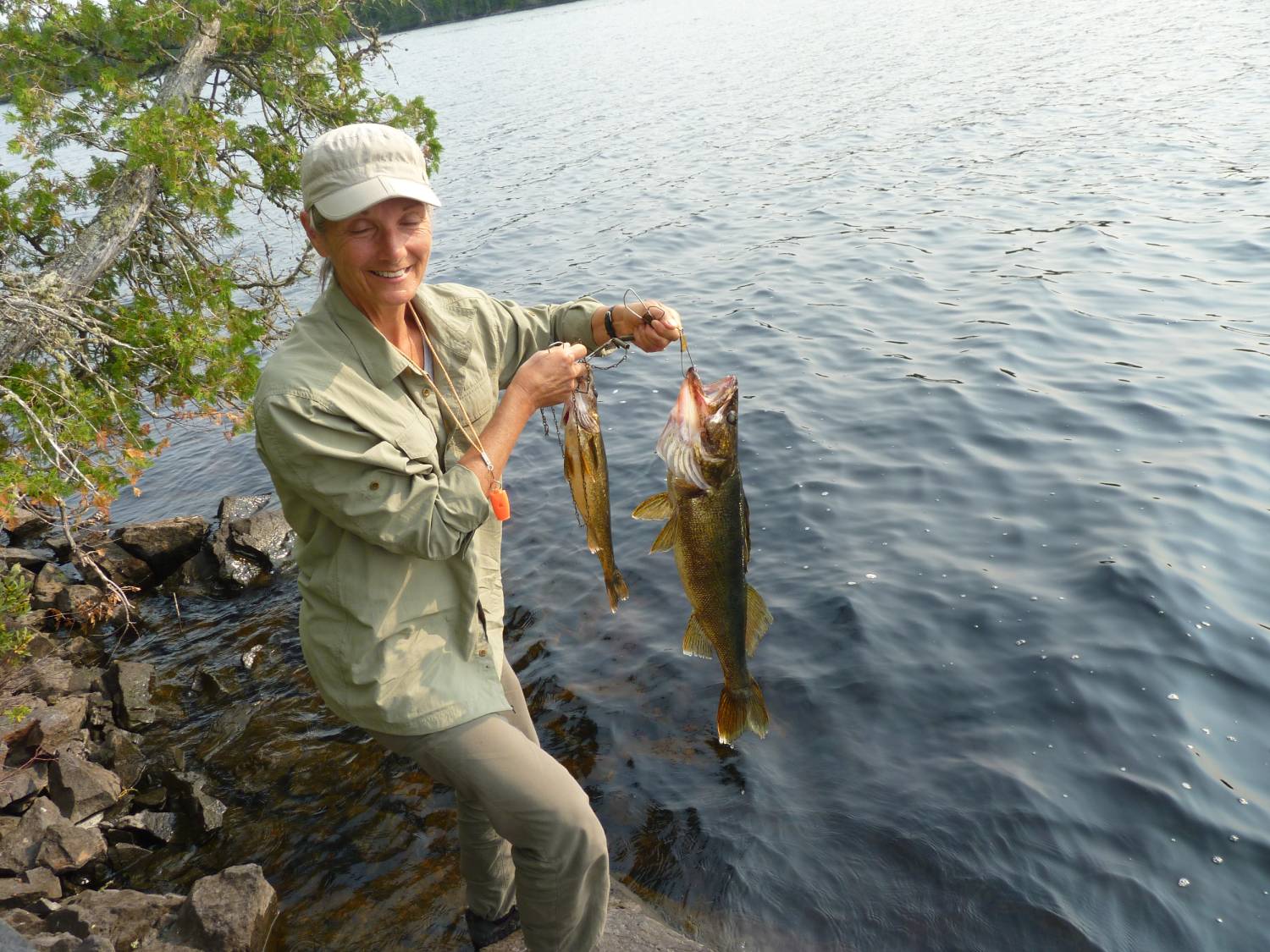
A short fishing excursion back toward our previous spot yields a couple of walleye ... we kept this one for dinner.
Walleye dinner ...
Time is gettingshort so taking advantage of a calm morning we start for the north end of Rice Lake ... passing the islands in the center of the lake we stop and look at a couple for potential camping spots ... there are some possibilities but the island that the fly-in guys use for shore lunches is a glorified latrine.
A one night stay on Rice north followed by two days on Rush and we're almost at the end of our trip.
We've got enough food left for a couple of days so we decide that on the way out we'll take the trip up the New Arbutus Road to Stoney Lake and paddle over to one of our favorite spots on Potier Lake.
The paddle into Potier was on a sunny afternoon so we soon had the site set up and spent a nice late afternoon swimming and sitting on the rocks drinking coffee.
We awoke to a very overcast and foggy morning that soon turned into drizzle.
This is not how we wanted to spend our last two days so as soon as we got a break in the rain we packed up and did the two hour paddle and portage back to the truck.
As the truck loading was completing the rain came back and continued with us until we were south of Parry Sound.
Discussion around how to get to Pebonishewi filled most of the trip home. Now that we'd actually seen it there's got to be a way that we can try those waters ... would we have to fly in?
The easiest route if we decide to resupply at our truck is to park at Mallard and go up to Rush and over to Rice then up to Wenakoshi ... that's three days to get in. Then we have to resupply which means retracing to Rush and Mallard before returning to Wenakoshi ... that's another four days. Finally the return trip from Pebonishewi will take four days. That's at least 10 days of back and forth paddling.
If we flew in to Rice we could be on Wenakoshi that same day ... if we had supplies dropped on Pebonishewi we'd waste no time with a resupply run ... and if we flew out from Pebonishewi we'd save another four days. So what's a saving of 10 days worth?
2015 - July 29 to August 27
Once the spring was upon us we began to plan for 2015 ... several calls to fly in services and we were sure that we wanted to use Ivanhoe air.
Ivanhoe has camps on all the major lakes in the area ... everyone we'd met on the lakes had nothing but good things to say about their service ... and George was an easy guy to talk with.
We arranged to get flown in to Rice Lake on July 29 ... a Wednesday since that's the day they run check flights to the camps in that area ... our resupply would get to Pebonishewi on August 12 ... and we'd fly out from Pebonishewi on August 27.
All we had to do was build a portage to cover the 1.6km from Wenakoshi to Pebonishewi and then slug our gear across.
I'd be 75 this year so this might be a challenge ... we plan four days to build the portage and then a rest day before the carry.
So on July 28 we make the drive from Hamilton to Folyete ... to avoid any traffic we leave home at midnight. With stops at Parry Sound and Sudbury for coffee we're at the Pine Grove in Cartier for breakfast around 8. The people here know us now and we always get filled in with the local hotspots as we share our plans.
We detour to Timmins for lunch and are at Ivanhoe Lake by 3pm ... it's a brutally hot day so we check in with George and Jean ... we're to stay overnight in one of their units at the lodge before we fly out at 8:30 the next day.
We bought some lettuce and tomatoes on the way so we have sandwiches and water for dinner after a nice swim in the lake to cool off.
Up at 6am ... coffee and granola ... get our gear down to the dock area and out on the dock to the plane ... Dave will be our pilot today ... we load up with our stuff and some supplies for the guys on Rice Lake ... take off at 9 and are on Rice north at 9:45.
We want to try to get to the south east end if possible ... but the wind is coming up from the south ... and its another scorching day.
We make it to mid-lake and pull up on picnic island for a rest while we sit in the shade ... the wind is really strong now so we decide to camp here for the night ... it's so hot that the fish aren't even biting ... but the swimming is good until a thunderstorm rolls in.
Good thing we planned lettuce and tomato sandwiches for the first few days because the heat and humidity are so high that we don't want to make a fire.
We're up early ... it's going to be another hot day ... two hours of paddling gets us to our intended site ... a shaded, protected spot. A little clearing and cleanup and it's home. the paths to the water on the other side of the island need cleaning up but we're soon swimming and fishing off the island. The heat does not relent so the rest of the day is spent swimming and air drying.
Another day at the south end and we make the paddle to the north end where we'll spend two days before going to Northpoint.
This is one of our favorite spots ... we've been camping here since the early 90's ... swimming is good and fishing in the vicinity is usually productive.
2016 - July 27 to August 24
As you may recall, we’ve been traveling the waters of Sakatawi and attempting to both improve the portages and convince some of you to use this forgotten area since 2008.
2016 was planned to be an easy year where we would retrace the path we established in 2015 from Wenakoshi Lake to Pebonishewi Lake.
This year we’d clean up the 1.6km portage, remove some of the sharp turns and narrow spots and have an easier time carrying our gear over.
We wanted to spend a month on the water without having to loop back to our truck to pick up supplies so we again arranged with Ivanhoe Air to fly us into Rice Lake where we’d spend two weeks on Rice, Northpoint and Wenakoshi Lakes before working our way over to Pebonishewi for the last two weeks.
Ivanhoe Air is very busy on Friday, Saturday and Sunday as they get people out to one of their 27 outpost camps and bring back the previous guests.
Check and resupply flights are scheduled for Wednesday and Thursday so we piggybacked on the Wednesday flights to get into Rice, get our resupply delivered to Pebonishewi and to finally fly back from Pebonishewi.
On July 26th as we drove north on 144 in the area of the Sultan road we could see that there had been a winter system that had bent and toppled more than a few trees along the highway so we were wondering what lay ahead on our planned “easy cleanup” of that 1.6km portage.
After an overnight stay in one of Ivanhoe’s lodge units we were up and at the dock ready for our 8:30 flight … and a smooth one it was. We were on Rice north by 9:30 and since the wind was fairly calm we decided to paddle to a site on Rice south.
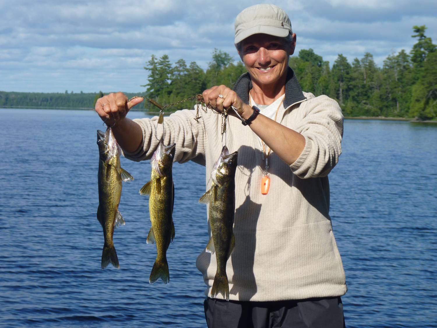
We stayed here for three days and did some exploring and the obligatory fishing … day 2 dinner shown here ..
Walleye dinner ...
Moving to our favorite site on Rice north was a bit of a disappointment … it had sustained a bit of wind damage and so required a two-hour cleanup before we could settle in … but we soon had the tent and tarp up and a pot of coffee brewing.
Tent's up ...
Coffee's on ...
Time to move to Northpoint … it’s only a three hour paddle up a lazy river and the beauty of Northpoint is that Ivanhoe does not operate that camp in July and August so we’re there by ourselves unless people from Rice decide to make the trip by motorboat which is not easy due to a couple of beaver dams.
Up a lazy river ...
I’ve said it before but it’s worth repeating … the fishing in this chain of lakes is very good.
Too much of a good thing … let’s move to Wenakoshi and face the task of clearing that portage and getting our stuff to Pebonishewi.
As expected the portage needed more than a little care … after six hours of walking and cutting we were back on Wenakoshi needing a swim and a bath.
The fishing is better in Pebonishewi so we tackled the portage the next day … it took us four hours … my 76 year old body can’t dance across portages the way it used to … but we made it in good spirits.
Only 800 meters to go ...
After a good long drink we paddled to our intended campsite only to find it completely blown in. This is a site that we spent several hours on last year … it provided both good swimming and fishing as well as a great vista … oh well.
We had another site further south so we headed there and fortunately it was unscathed.
Pebonishewi did not disappoint … we had built three campsites last year and visited each of them … we also constructed a new site to replace the one that was blown in.
Fishing here is still great …
This campsite survived ...
What are you waiting for? ...
We portaged south to Owatawetness for an exploratory trip … there were no places that called out to us for camping … the lake is shallow.
After exploring we decided to fish our way back north and were rewarded with a nice bass and walleye combo …. We brought these back to Pebonishewi for dinner.
Owatawetnes catch ...
We flew out on August 24th in great weather.
What do we have to do to get you to visit this area?
I’m coming to the end of my canoeing years … maybe a couple left yet … but this area needs to get used if the portages are to be kept open.
Here's a map of our trip with the portages marked ...
Rice, Northpoint, Wenakoshi, Pebonishewi ...
2018 - July 17 to August 30
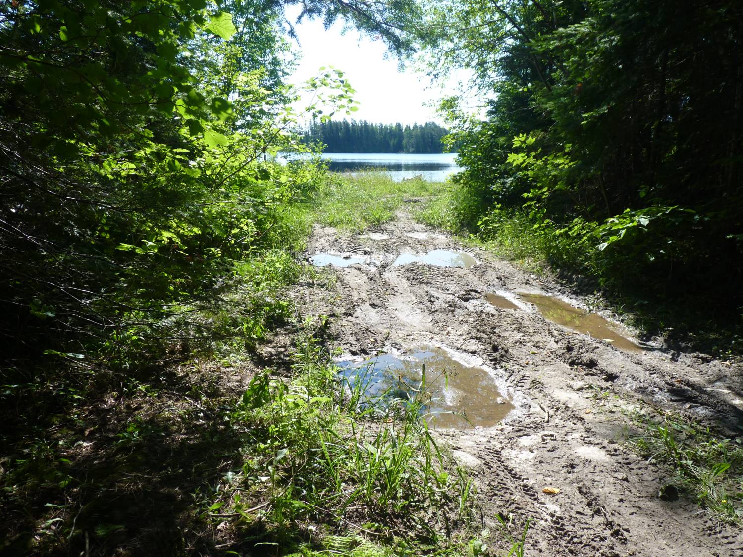
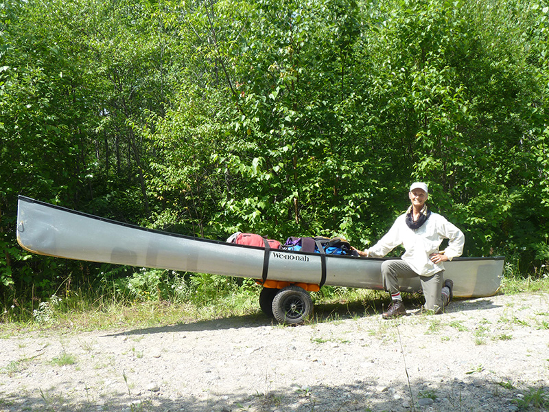
This year we decided to try another approach to Rice Lake … we bought a canoe cart thinking that a trip to Little Rice and out to the road which gets to Rice would be a better option than the two 1000 meter portages from Little Rice or the 5 portages up the Rice river from Rush lake which total about 1300 meters.
Remember that I'm 78 this year … portaging isn't as easy anymore.
The overview.
This year's trip was 40 days and involved three legs.
The first was 19 days from the bridge over the Opeepeesway river to the east end of Opeepeesway lake then up through Little Rice and out to a gravel pit where we assemble the canoe cart and haul our gear the three kilometers to the trail leading down to Rice lake.
The ATV trail to Rice lake is about 600 meters and we remembered it as being pretty easy going for at least half of its length before it degraded into a boggy mess.
The second was 12 days on Kenogaming lake with a side trip to Kaneki lake.
We met the owners of Thunderstock Outfitters a couple of years ago at the Hamilton Outdoor Show and got their brochure. Kenogaming lake was easy to find on Google Earth and it looked like we could access the lake at its midpoint, so we thought we'd see what it was like.
The third was a trip back to Pebonishewi lake … not an easy place to get to but the fishing was great and we'd established some nice campsites.
The detail.
We began the first leg on July 17 by driving to the bridge over the Opeepeesway river and paddling south to enter the main part of Opeepeesway lake and camping for the night on one of our favorite spots. Unfortunately, this spot gets used by spring fishermen and they've manicured it with chainsaws over the years so that its getting too open for our liking.
Our jumping off point was to be the east end of Opeepeesway so we moved there and rested for the push to Rice.
The trip to Rice begins with a paddle, a lift over at a beaver dam, a 100 meter portage into Little Rice, and a 200 meter portage out to a gravel bank.
Here we assemble the canoe cart, load it up, and haul it 3 km to the ATV trail into Rice lake.
Canoe Cart
It's a really hot day … we get to the gravel bank at 11am … the fully loaded cart weighs about 250 pounds so its not that easy to move over the slight rises in the gravel road … then we arrive at the ATV trail and realize that its rutted up enough so that we'll have to carry the 600 meters into Rice lake.
The portion of the trail near Rice lake is still a mess … it hasn't been used recently but its still a mud hole requiring some careful routing and foot placement.
We completed our two carries and were on the lake at 2:30 pm.
There was no breeze, so we put our backs into it and paddled the two hours to get to our favorite campsite.
We go for a swim and purify a couple of liters of water to begin our rehydration as we setup camp.
Dinner is a couple of sandwiches and lots of water … no energy to build a fire and cook dinner.
Over the next fourteen days we changed campsites three times and at one point we ate fish six days in a row … only stopped because we realized that we had to carry our leftover food back to Opeepeesway.
Rice fishing is still good
The trip back to Opeepeesway was a little easier … a cooler day … still a slog up the ATV trail but a lighter load … slightly downhill with the canoe cart.
Here's me on the last portage of the day … the 100 meter out of Little Rice.
Last portage
The second leg involved moving the truck back out to 144 and north to the road to Kenogaming lake … about 42 km north of Gogama.
We stopped in Gogama for lunch and explored the Gogama Unit road before heading north and into Kenogaming lake.
We arrived late so we had a sandwich and slept in the back of the truck.
Headed out on the lake at about 8 am and began to look for a place to camp … we found a spot that needed a bunch of clearing but was otherwise ideal. Three hours later we were ensconced in our new home … fireplace built … tarp up.
Construction begins
Tent's up
Tarp in place
We had high hopes for this place … there was a nice place for swimming … the water got deep quickly just off the site … but fishing was a disappointment … only a couple of small walleye and pike.
View to north
We paddled around the lake on a calm day and located a nice spot to camp at the north end of the lake so we moved up there.
Scenery was great here again as was the swimming … but the fishing was still poor.
View to south
We had intended to move over to Kanecki lake but with the poor fishing we decided to cut our visit short.
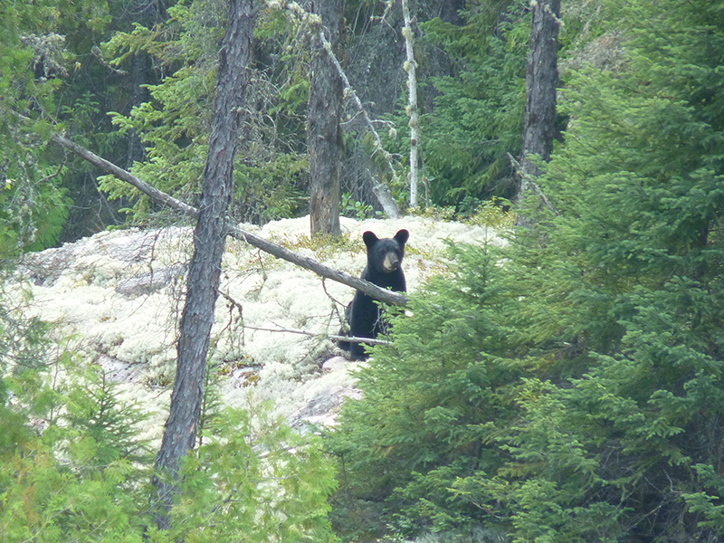
By the way we had an observer … this young bear appeared on the opposite shore and watched us for a while before moving on.
BoBo came to watch
The third leg started by an overnight stop at Peach lake … just south of the Sultan Road … to get our stuff dried out and do the resupply before the slog into Pebonishewi.
Pebonishewi was all we remembered … our old campsites were still in good shape (nobody comes here to camp) … fishing was still phenomenal … once again we ate fish until we realized how much we had to carry out.
Typical Pebonishewi bass
Pebonishewi walleye
The biggest smallmouth I ever caught ... he still swims there.
Billy Bass
We came home with enough food to stock our first two weeks in 2019.
The happy couple drying out after the trip
So come on guys ... we can't keep these routes open forever. We've been doing these routes since 2008 and its about time for someone else to pitch in.
2019 - July 10 to August 27
We’d like to spend about 30 days on Rice Lake this year but the logistics are difficult.
Thirty days means another food barrel and some extra supplies … stuff like TP, toothpaste, soap …
Then we gotta figure out how to get it to Rice Lake.
I’m 79 this year so I really don’t want to do the five portages up the Rice River with the extra 50 pounds of food and while the canoe cart worked out well last year I’m not sure that adding another barrel to the load won’t make the trip up the road too difficult.
If we can figure out how to get our food to Rice Lake we can then use the cart for the rest of our stuff ... but how do we do that?
SOLUTION ... We proved that the canoe cart is a viable option so we thought that we'd drive to the ATV trail into Rice and stash our food there and then use the canoe cart to get the rest of our stuff up the 3.5 km from Little Rice .
Remember that you are not allowed to use a motorized vehicle to access Rice lake but if we're just dropping off supplies we reason that we're within the law.
Left home at 10pm on the 10th ... arrived at the Watershed around 5:30am ... a few thunderstorms on the way.
Headed west on the Sultan road to the Yeo road (Rice lake road) and turned north.
Things are going well until we come to a portion of the road that's flooded ... pesky beavers!!!
We can see the gravel bank where we'll come out from Little Rice but we're stymied.
After some discussion and cursing of the beaver clan we decide to leave our food resupply here and retrieve it in a few days.
This means that we'll have to make an initial trip just to get our food resupply to Rice ... BUMMER!!!
We cover the barrels with plastic bags and leave them hidden in the bush ... bugs are bad.
Now we proceed to drive south then west to the Mallard Road and north to the bridge over the Opeepeesway river.
After a buggy launch we were assisted by a northwest wind and made great time getting to our site on the east arm by 3:15.
A rest day was needed to recover and come up with plan B.
Kathy caught a walleye that we had with miso soup.
Plan is to move the resupply barrels to Rice lake tomorrow.
Day 3 ... sees us leave camp at 9am on a cloudy cool morning.
We've got the canoe cart and items we think we'll need for the trip to Rice and back ... lotssa water.
Over to Little Rice ... out to the gravel bank ... assemble the canoe cart ... paddle across the beaver pond and walk to the spot where we've cached the barrels.
PROBLEM!!! ... one of the barrels is missing ... looked around and followed a trail of mashed vegitation for about 50 yards before we spotted our barrel.
Fortuneately it's intact ... only a puncture wound in one of the straps ... we're lucky.
We get both barrels down to the pond ... into the canoe and across to the road where we load the cart and start the 3.5km trek to the ATV trail then the 600m portage down to Rice ... bugs are bad here.
Stashed the barrels under a boat and returned the road to begin the hike back to Little Rice ... the 250m carry to Little Rice ... the 100m carry to Opeepeesway and now its just a paddle back to our camp.
BUT ... wind is up out of the west and is so strong that we're not making any headway ... ferry over to the south shore and pull up to a clearing where we spend the next 3 hours until the wind dies enough so that we can paddle.
Got to our site at 7:30 ... had some scrambled tofu wraps ... muscle and back pain tablets ... lotssa tea and hit the hay.
If the Red Cross calls tell them that I gave my pint today ... deer flies and mosquitos were bad along the road and on the ATV trail.
Day 4 ... I really need a rest day ... and it's a glorious day ... calm, quiet ... bright sun ... lazed around with gallons of coffee ... Kathy wet a line with no results. Tomorrow we plan to do the forced march back to Rice Lake.
Day 5 ... Dawns calm and cool ... by 11 we're starting up the road to Rice ... sun comes out ... nice breeze ... we're at the ATV trail at noon ... record time!!.
Now to portage our stuff the 600m to Rice ... as usual it's a double carry and I angst about getting the canoe through the boggy section but all goes well ... cached supplies are untouched ... donated more blood.
Launched onto Rice at 1:30 ... breeze from the south helps us get to our planned mid-lake site at 2:30 ... we're setup and moved in by 4:30 ... wind is up from the south keeping the bugs at bay.
Day 6 ... July 16 ... WINDY and hot ... alternate cloudy and sunny as the cloud formations raced over.
Kathy starts fishing off the point ... first fish is a bass - they are getting more plentiful as the years go by.
Soon she's got 4 walleye and a pike ...
kept two walleye for dinner
Wind dies at around 9 as we're in the tent reading.
Day 7 ... What a great sleep ... and a perfect day ...
I caught two walleye
right away so dinner is settled ... spent the afternoon swimming and relaxing in the sun.
Tomorrow we plan to head north and stash our resupply food barrel.
Day 8 ... Up at 6 and on the water at 8 ... wind from the south causing a chop ... clouding up to the west so we decide to head straight to our intended site rather than looking for a place to stash our extra food.
Rain starts to fall as we unload but it's only a shower and sun comes back out. We're setup by 10:30 ... coffee is on ... fishing commences but it's a catch and release day ... hot, humid thunder in the distance.
Rain starts at 3:30 ... dinner is granola ... soft rain falling as we drift off ... distant thunder.
KABOOM!!! ... lightning flashes and the ground shakes ... it's 11:30 ... rain pours down for an hour then all is calm again.
Day 9 to 11 ... Hot, sunny and humid ... wind picks up from the west ...
fishing yields a bass and a walleye .
We stash the extra food back in the bush ... so hot we swim before heading off to sleep.
We decide to move ... not to Northpoint as we had planned but to the southeast since the breeze is from the north.
On the water at 9:30 and at our southeast site at noon ... good time.
After setup ... coffee and breakfast ...
Kathy catches two walleye right away ...
lazy afternoon ... heading for the tent at 9.
Day 12 ... July 22 ... We're off to explore the southeast arms today. Kathy has spotted a place on Google Earth that might make a possible campsite. We find the spot ... it has possibilities but a few casts turn up nothing ... wind is up now from the west making the paddle back to camp difficult. No fish here either ... lasagna for dinner.
Day 13 ... Paddled north today ... toward Ivanhoe's south camp to explore a section we haven't been on in a couple of years.
We pass a place that has potential as a campsite so we stop there on the way back and guess what? ...
There's a log cabin frame here... walls and a ridge pole
... there's a small lean-to out toward the water ... best of all there is no trash. It's pretty close to our current site but worth keeping for the future.
Day 14 - 16 ... Headed back north today to a site we prepared two years ago ... arrive to find a blowdown across the tent pad so out come the tools. Tent area moves further back into the bush and old tent pad becomes tarp area.
Wind up from the south ... it's hot and sunny ... fish aren't biting but water is nice for bathing.
Looking stormy and we're supposed to resupply ... although we're not out of food yet ... so we move to be near our supplies.
Fish still not biting but we've got lots of leftover meals ... swam a few times to cool off.
Day 17 ... Begins with a thunderstorm at 6am ... after coffee a few casts and two 16" walleye are on the stringer ... thunder off to the west ... rain comes at 3 ... we retrieve our cached food but do not open it yet because its starting to rain.
At 5pm sun comes out ... fish dinner ensues and we open the resupply barrel ... calm and beautiful sunset ... off to Northpoint in the AM.
Day 18 ... Sun is out and its a bareback paddle to Northpoint ... no bugs and the water is high enough so that we paddle over the couple of attempted beaver dams.
Our campsite is just as we left it two years ago ... still hot and sunny so we take some time for a swim and bath.
Day 19 - 20 ... RAIN!! ... a suprise after a clear evening ... it's afternoon before clearing starts ... then it's wind from the north ...
and misty .. Fish are not co-operating.
Another misty day ... Kathy tries fishing in a new spot
and soon has dinner arranged
... off to Wenakoshi in the morning.
Day 21 - 22 ... It was cold overnight ... 9c in the tent as we rise ... heavy dew so we take our time packing up in order to let the tent fly and the tarp dry out a little.
We're on the water a little after 10 ... an hour to the mouth of the stream which is the outflow from Wenakoshi.
Another hour and thirty after negotiating a couple of beaver dams and we're at our site. Nice and warm, hardly any breeze.
Once again there's been nobody here; but we expect that here, it's out of the way and the fly in guys can't get here with thier motor boats.
In the afternoon we watch a bear patrol the opposite shore.
After dinner two moose appear in the bay just behind our camp ... looks like a cow with last years calf ... they brouse a little, take a brief swim and head up into the bush ... they'll pass within 30 yards of us but the bush is thick enough so that we can't get a good picture ... as the moose leave we're engulfed in a horde of mosquitos ... they must have been following the moose until they smelled fresh blood ... scurry for the tent and spend the next 20 minutes swatting.
Fog again in the morning but warmer ... sun is up and soon things are dry.
Over coffee we discuss our plans for our remaining days ... we've got a week left before we head back to Opeepeesway.
Lounge away the day.
Day 23 - 24 ... Another beautiful morning as we have coffee and pack up for our trip back to Rice Lake.
On the water at 9 and out to the Rice Lake by 11.
After camp setup we go through our remaining food and plan our meals so that we eat the heaviest items ... don't want to carry any extra weight back to Opeepeesway.
After dinner we can see rain to the north ... thunder in the distance ... then it's here ... well into the night.
Stayed warm all night ... cloudy start to the day but sun comes out at 8:30 ... eat one of those heavy meals.
Day 25 - 27 ... Foggy and cool this morning but coffee and packing go well ... we're on the water at 8:45 and headed for our southeast site. We set a course so that we'll pass Ivanhoe's south camp - we haven't seen it in a few years.
There are a couple of guys on the dock ... they're from Buffalo ... thier second visit this year.
Arrive at our site at 12:30 ... hot, calm day ... fish are not biting.
Southeast Camp Setup .
Warm overnight ... wind up from the south as we sit in the sun for coffee ... wind switches to west and stronger ... fish are biting ...
dinner on the stringer.
Tomorrow is supposed to be move to our get away site ... a midnight thunderstorm puts us in doubt.
Everything soaked this morning ... rocks slippery ... move postponed.
Skies clear in the afternoon ... looking forward to moving.
Day 28 - 30 ... Perfect day to move ... clear skies and light breeze ... as we have coffee a cow moose appears across the channel from us but doesn't stay long.
On the water at 8:40 ... shirtless paddle ... at our next site by 10 ... set up and coffee in hand by 11:30.
Kathy catches a pair of walleye ... 18" and 17" ... as we're starting to fry those fish the wind comes up ... thunder all around ... rain comes ... guess we're not headed out tomorrow.
Rained all night ... windy again today ... things dry out but wind is strong enough so that I don't want to cook over an open fire.
Wind was gusting all night ... we decide to stay another day ... spent the time setting up a new tarp location ... a couple of sunshowers ... still too windy for cooking fire.
Day 31 - 32 ... Up early as we're anxious to go ... on the water at 7:30.
At the takeout point there are two canoes and a pack sitting there ... we meet the owners on the trail and stop for a chat ... they're from Cambridge ... wanted to do the lake after reading our site ... they've come in by pickup and left the truck at the start of the ATV trail.
As this is happening 2 ATVs also arrive with a 14' aluminum boat ... so much for the "No Mororized Access" rule.
Retrieved the canoe cart and loaded up we start back to Little Rice ... pleasant walk ... only a couple of stops.
We make it onto Opeepeesway but the wind is up so we paddle along the north shore all the way to the narrows before turning and surfing to our campsite ... arrive at 2:15 ... a grueling day ... my old bones are tired ... doubt if I can do that again ... canoe cart for sale.
Turned cool overnight ... we take our time ... up at 8 ... coffee in the sun ... a swimming and bathing day ... eat our last packaged dinner so I guess it's time to leave in the morning.
BUT WAIT!! ... it's raining again.
Morning dawns cool and cloudy but no wind yet ... we decide to make a run for it ... make good time across the main lake and as we start down the river to the bridge a pack of wolves begin howling just off to the east ... really close ... we stop to listen for a minute.
Take out and pack up go well and we're off to see if we can find a new way into Pebonishewi.
Last year we explored Owatawetness and found an ATV trail that led out to a road ... we followed the road for a bit and took a few GPS readings.
Over the winter we used google Maps and those GPS readings to see if we could figure out how to get to the ATV trail.
Map and GPS in hand we start out ... BUT NO!!! ... the road is washed out ... it's good up to here and appears good on the far side but we don't want to chance going through here ... we'll leave it for another year.
So a planned 45 day trip gets pruned to 32.
We spend the next two weeks at the Temiscaming Fish and Game Club.
2020 - July 7 to August 22
We're starting early this year - July 7.
Everything is about Covid-19 ... face masks ... hand washing ... social distancing.
Yep ... Makes us want to get out of town early ... bugs or not.
Big year for us ... Kathy's 65 and I'm 80
We're pretty sure that the years of portaging into Rice are behind us so the plan is to do Rice, Bagsverd and Pebonishewi ...
We've arranged for Lauzon Air to fly us from their base on Marquette Lake to Rice for 30 days then we'll return to Marquette and drive to Bagsverd for a few days before heading to Pebonishewi.
We leave home at 9:20pm on the 6th ... we're supposed to be at Marquette lake by 7 ... it's really hot in the city so it's nice to get away.
We're at the lake by 4 and try to catch a few winks.
At 6 Ray - the pilot - is out by the plane so we pull up to the dock and begin unloading.
We're all loaded up and it starts to rain so we wait for it to clear.
At 9am we're off ... Ray has not been to Rice lake in a few years so he circles a few spots before selecting Ivanhoe's north camp for a landing spot ... this works out well since it's not occupied.
The unoccupied camp is what we expected ... Ivanhoe's clients are mostly Americans and with the border closure they can't get here.
As we flew up the lake I saw a green tarp and some people at what we had planned as our first campsite so as we began our paddle I suggested that we stop for a chat ... but by the time we got there all we saw was a canoe off in the distance headed for the outlet.
It's hot and humid now ... sweaty just setting up camp ... multiple swims ... water is warm for this time of the year and the bugs are out.
Kathy catches a nice walleye but doesn't want to cook it so after a couple of more swims we settle for one of our packaged dinners.
At 8:30 we're driven into the tent but it's still 26 c in here ... and guess what ... there's a rabbit that visits a couple of times.
A regular visitor
Day 2 - WOW! is it ever hot! ... Drinking lotssa water and swimming ... we paddle over a nearby campsite we plan to use later just to get out where the air is moving ... return and start fishing ... soon two walleye on stringer.
Weather is calling for thunderstorms for the next two days so we make plans to leave early in the morning and head to the southeast where there is a well protected site.
Day 3 - Up at 5:30 ... on the water at 7:25 ... slight breeze from the south which is nice even though it's in our face.
Two hours later we're pulling up at our destination ... still really hot.
Once camp is up I put up a clothesline so Kathy can wash some of our by now stinky clothes ... thunder in the distance but no rain.
By the way .. you'll notice talk about the weather forcast ... we're getting the forecast from a device called a ZOLEO.
It's a satellite device that allows a bluetooth connection from a cellphone to the ZOLEO device so that texts can be sent and recieved over the Iridium satellite network. It also provides a weather forcasting service that is based on your location.
Forecasts are for five days but detail only for two ... we use wind speed and direction to plan our moves.
Two complaints ... location is in Lat - Lon ... Temperatures are in Fahrenheit.
If it knows my location why not report in the units of that location?
It's battery life is good ... we only turn it on about every third day to check in and to get the weather ... we can charge it with our solar panel but it lasts for our full 30 days.
We recharge it in the truck after flying out ... before starting the second leg of our journey.
Day 4 to 6 - Still hot but fish are biting ... lazy day ... first meal at 1:30 ... rain in the distance so we hustle to get dinner ready ... dinner under the tarp in the rain - heavy at times. Rained off and on all night
Now fish stop biting ... thunderstorm must have sent them deep.
Sunday dawns cool and misty ... 16 degrees ... bugs are out after all that rain ... today is changeover day at Ivanhoe's camps but no planes are flying ... we've been alone on the lake for a week now and really enjoying the solitude ... showers start up ... can't sit under the tarp because of the bugs so dinner in the tent.
We plan to depart in the morning ... Zoleo says light wind and sunny.
Day 8 - 9 - We're up at 5:30 ... coffee on breakfast rock as we let the dew dry off the tent fly and the tarp ... on the water at 7:45 ... light breeze from the south pushes us along.
We stop to check on our food cache ... all's well after all that rain.
After setup is complete Kathy catches two nice walleye ... then a bigger one - 20" which gets released.
Showers overnight and again as we're out for our morning coffee ... skies cloudy all day.
Day 10 - July 16 - A glorious sunrise ... light breeze from the south.
Kathy's out fishing when a moose walks out at the base of our point ... it just looks around and heads back into the bush.
I sneak back to see if I can get close to it but it melts into the forest.
It's such a nice day that we take a paddle over to the outlet and around the bay there.
The water is high enough so that the usual riffle at the start of the Rice River is awash.
We fished on the way back to camp and were rewarded with two walleye.
Day 11 - Moving south this morning so we're up at 5:30 ... wind starts at 7 ... on the water at 7:30 ... wind builds as we approach the mid-lake narrows. We now need to cross an expanse of water to get to our destination ... wind in our faces and a few whitecaps but nothing we can't handle.
As we're setting up wind gets stronger and waves are marching up the lake ... good thing we got an early start.
This point gets used in the winter as a base for ice fishing so we spend some time cleaning up the stuff that gets left behind.
We found one item that someone might want back ... a hatchet with engraving ... let us know what the engraving said and I'll mail it back to you.
Fish aren't biting ... as we're sitting out a groundhog comes wandering through the site and two small rabbits appeared late in the day.
Day 12 -We get visitors .... we're sitting out on the point having a coffee when we hear a motorboat approaching from the south ... it's occupied by two couples ... they're startled by our presence but pull over for a chat ... lets see - as I recall they were Cory, Ann, Danica and Ben ... Cory recognized us and said he'd been on our web site ... told us that there had been an A-frame camp here in the winter ... that's why we're not finding a firepit this year they must have had a woodstove .... they motor off across the bay and begin to fish ... two hours later they're leaving with their limit.
Skies darken and there's thunder off to the west ... good thing I fished earlier ... dinner on the stringer.
Rain starts after breakfast.
We clear a spot back in the bush for a tent pad ... it's more sheltered here ... we'll use it next time.
Fish are cooked and eaten under the tarp in the rain.
Day 13 - 14 - July 19 - Ivanhoe turnover day but nobody comes ... showers overnight and it's a misty morning ... everything is wet ... takes 3 hours for tent and tarp to dry ... wind is up again so we decide to move the tent to our newly prepared area.
We had hoped to leave this morning but the wind is up and we're getting showers ... coffee in a protected area ... showers become rain ... plan to get away tomorrow.
Day 15 - 16 - Up early and headed north ... we pass a point we'd seen before and noticed that it had been used as a campsite so we stopped for a look ... it passes inspection so we'll come back to work on it later.
Continuing to our site we set up ...
Kathy catches dinner
Tomorrow is resupply day ... we've been alone every night and most days ... a couple of times a float plane has come in - guys fish for a couple of hours and leave.
Resupply goes well ... we retrieve the barrel, sort out all the items and repack the food barrel ... leftovers go back in the resupply barrel and it gets restashed.
We redo our trip plan for Rice Lake so that we get to spend two nights on each site ... winding up at Ivanhoes north camp in time for our scheduled pickup on August fifth.
Day 17 - 18 - Dawns really foggy ... can't even see the nearby island ... over coffee it starts to clear so we pack up and hit the water.
We've picked a new spot ... one we've never camped on before although we've visited ... it's an island that we pass often since it's situated just south of the mid-lake narrows ... the drawback is that landing and launching are difficult due to it's steep and rocky approaches.
We know people that have camped here ... there was a permanent tent here the last time we visited.
We arrive and get our gear up to the site ... the old tent is down and covered with pine needles and moss ... I drag it back into a spot where it won't be in our way ... there's also an old tarp covering some old rusted utensils and kitchen gear ... it gets moved to join the tent.
It's seen better days
Fire pit is out in front and overlooking the lake
... a nice view
... made a pot of coffee and we had breakfast ... then Kathy clears a path to a swimming spot ... we try it out.
Kathy finds a strange memorial ... a rock crypt with a statue of a lion lying down with a lamb ... does it have anything to do with the island not being used for the past few years?
... Why is this here?
We decide to leave in the morning.
After a great night's sleep we manhandle our gear and canoe down the steep bank, load up - and we're outtahere.
We set a course to pass Ivanhoe's south camp ... we'd like to have a look inside but upon approach there's a plane at the dock and about six people there.
They are from Toronto and just up for the day ... must be nice ... the plane was a ten seater and they had made arrangements to use Ivanhoe's boats.
After camp setup we went for a swim ... it's hot again ... fish are not biting.
Day 19 - 20 - Cloudy windy morning ... we both catch nice walleye ... hot and humid in the afternoon ... tough to sleep ... Rain starts at 11:30.
I had taken the tarp down so that we could get away quicker in the morning.
Still raining at 5:30 but it stops at 6 ... scramble to pack up and go ... cloudy, misty, hot, humid ...
Arrive at campsite ... setup ... swim and fish ... nothing for stringer.
Day 21 - 22 - After coffee we paddled to the site we had found at mid-lake so that we could prepare it for occupation.
After a couple of hours we had the place ready ... we fished our way back to our site ... no luck ... breakfast and a swim ... still hot.
Cooled off overnight ... Kathy has a sweater on ...
With departure only five days away we paddle over to check out some places where we could stay that would be close to Ivanhoe's north camp. We want to be close in case the wind is up making paddling tough that day ... we need to be there at 7am so it means an early morning. A couple of likely spots including the area right at the dock.
Fished our way back ... one on the stringer.
Kathy continues to fish and soon hits the motherlode ... fish, mashed potatoes and mixed veggies for dinner.
Day 23 - We wanted to go to Wenakoshi this morning but we're greeted with showers on and off all morning.
Fishing yields results ... the rabbits are out early today, an adult and two kits.
Day 24 - Wanted to go to Northpoint this morning but weather is not cooperating .... low cloud, mist. After coffee we decide to move south so we pack up and head out.
We delay putting the tent up in hopes that the pad will dry out but not to be ... shower headed this way ... Kathy gets the tent up in record time ... pitches the clothes and bedding in just in time ... breakfast under the tarp in a slanting rain.
Rain dissipates ... Kathy goes fishing and I try to figure out why our stove is burning poorly ... Kathy is more successful.
Day 25 - 26 - Calm cool morning ... after coffee we go back to that new site we're working on .. I made a trail to a nice lookout spot under a big white pine and constructed a fireplace ... Kathy improves tent pad ... the place is declared ready for occupancy.
Back at our site Kathy catches two good size walleye ... we've had fish three days in a row so these were released.
Now it's Civic Holiday and still no-one here ... rose to a cloudy day ... looks like rain so we move north to get closer to our pickup point in caseweather turns bad ... forecast is north wind and much cooler.
Day 27 - 28 - As forecast it's much cooler this morning with a north wind ... fish are not biting ... north wind blows right into campsite making it uncomfortable.
Ivanhoe's north camp remains empty so that opens up the possibility of camping there.
Cold overnight ... in the 50's F ... sky cloudy ... after coffee I catch a 20" walleye and Kathy gets skunked ... breakfast and more coffee ... then more fishing ... we catch two nice dinner size fish so I release the one I caught earlier.
Consulted the Zoleo for weather ... we'll leave tomorrow ... maybe stay in the cabin since it's guaranteed to be warmer and drier.
Day 29 - Cool ... not as bad as yesterday but after coffee the wind starts to come up and it looks like rain ... we decide to leave today rather than wait.
We go over to the cabin and I set up our stove on the porch to make breakfast,
I've brought some firewood so we can use the woodstove to warm the place.
Kathy calls Ivanhoe to tell them that we're here ... she supplies a visa number ... they recognize that we're past customers ... a charge never appears. Thanks Ivanhoe.
With a fire in the woodstove it soon becomes warm in the cabin ... we set the alarm for 5 so that we'll have lots of time to get our stuff to the dock and to clean up the cabin.
Day 30 - Up early ... packing up by headlamp ... coffee and muffin (I made last night) ... cleaned up the camp and packed our stuff down to the dock ... there's a shower coming but it turns out to be a fog bank.
The plane appears, lands and ties up at the dock.
... Load quick - rain's coming
... we're off to Marquette Lake ... a few showers on the way.
After we unload and pack up the truck we head south ... stop in Cartier to have breakfast at the Pine Grove ... they recognize us here now since we usually stop in on our way past.
Breakfast done we go to Chelmsford to get some fresh fruit and veggies ... we'll have lettuce and tomato sandwiches for the next few days.
Went to Peach Lake for the night ... slept in the back of the truck ... it was cold overnight with a heavy dew which means that all our gear left outside is now pretty wet.
At least the sun is out so we load up the truck and drive to the Watershed where we get a coffee to go and head for the paved rest area where our gear can get spread out to dry.
Repack the truck and head for Bagsverd Lake.
I was on Bagsverd in the early 80's having come up from Dividing Lake on a solo trip ... I was amazed to find a bridge at the outlet and used that access several times to get to Schist Lake.
With no specific memories of Bagsverd we're on an exploratory venture ... looking for places that are easy to get to ... translate to minimal or no portaging required for the day when I find it too difficult.
As we enter the main lake there's a campsite on the north shore ... it's well used so we move on.
A site out on the main body of the lake appears so we setup there ... it hasn't been used recently but contains a big fire ring with the accompanying large charred area.
Our stay here is three days which gives us time to explore the lake ... try some fishing, and to see how busy the place is.
This is a lake that was known for its good fishing so there were people on the lake every day.
They'd come mid-morning ... troll around the lake and leave in the late afternoon so we never got a sense of solitude.
Fishing was so-so but after Rice Lake most places seem that way.
There was one party of two canoes that came through on thier way to Schist and beyond ... they stayed one night on the campsite we passed up.
Not a bad place but after being alone for most of a month it seemed busy ... but it was easy to get to ... if we come back we'll try to get a site that gets more morning sun.
Day 33 - So we're off to Pebonishewi ... on the water by 7:15 ... load up the truck and head out ... road seems well traveled
... here's why
So moving up the road we stop to take a picture of the vista from the top of a hill
... the road to nowhere
You may remember that back in 2015 and 16 we portaged in from Wenakoshi and explored south through Owatawetness where we found an ATV trail that led to a road ... we took some GPS readings and tried to figure out how to get back by truck.
Last year the road was washed out so here we are making the attempt again.
With logging and mineral exploration going on you can imagine the number of roads and branches that exist but we stick to the most traveled paths and keep in mind our GPS destinations.
There are so many forks in the road that we stop at several and mark our path so that we can backtrack if we have to.
We're getting close and we come upon a tent beside the road ... no-one here but there's a table with a campstove and a truck.
A little further ... maybe 300 yards ... we recognize the end of the ATV trail ... it has been used so we shoulder a pack and head out.
The trail is clear and 800 meters later the lake appears ... it's as we remembered ... a few boats cached ... a rough launching area.
We head back to the truck for our final load and encounter two ATVs coming in ... a couple of guys and five kids ... in for a day of fishing.
A short chat reveals that they know of us through this site and that the ministry intends to close off this trail in the near future.
By the time we get back with the canoe and food barrel the guys are also ready to launch so we all get on the water.
They've got small outboards so we can move almost as fast as they can.
We unload at the north end of Owatawetness ... this is a tough takeout with lots of big boulders to get up and over ... and make our way over the path to Pebonishewi ... the path is open but not well used ... looks like it's used by snowmobiles for ice fishing.
Sure enough there's a big fire pit at the end but now there are three boats cached here ... along with a couple of bags of empty beer cans
... Carried them in full
... don't get me started!!!
We've got a nice campsite not far from here that we established in 2016 so we head there for our first stop.
HOLY CRAP!!! ... the chainsaw brigade has been here ... what was once a nice, well protected site has now become devoid of shoreline protection and the area behind the site has been cleared of all the dead standing trees that were there.
My nice small fire area is now five feet across and there's a pile of thigh size logs stacked nearby.
I had built my fireplace using a boulder for a chimney that I couldn't get my arms around ... we used it for probably a total of six days in our tours around the lake ... now with the "new configuration" its split ... that takes a really hot fire.
After some choice words we clean the place up and get setup ... but now the west wind blows right through making it difficult to maintain a good tarp setup ... we stay only two nights ... the one consolation is that the fishing is still good ... bass for supper.
There are three other sites we plan to use ... we cross our fingers that they'll be untouched.
The next site is as we left it ... the firewood I left is still there ... we stay for three days before moving on.
... central site
Fishing here is not as good as it once was.
On a calm day we paddle around the lake looking for some other possible campsites ... we find one good possibility.
Passing the site that we first stayed on in 2015 that got blown in we decided to give it another chance so we assessed the spot ... and deciding it could be saved it's on the list again ... we'll return with tools when we're in the neighborhood.
Our next site is toward the north end of the lake near Ivanhoe's camp ... it's clearly visible from the water and access is easy so we expect to find that it has been used.
We're not dissapointed ... someone has been here for a shore lunch but they left their fish carcasses in the shallow water ... it stinks and a pair of gulls have found them so we have to retrieve the mess and deposit it in deep water.
My firewood was used but that's easily replaced
... this is a nice site
We stay here for three days ... fishing and swimming are great at this site and we have time to go back to the blown in site and prepare it.
Pebonishewi is not so big so it's fairly easy to circulate among the campsites we've established ... there are five now ... so we can spend two weeks here without over-using any of the sites.
We get a great string of weather and fishing stays good ... bass are always hungry and willing to hit almost anything ... we comment that we're not catching many pike and then Kathy hooks ...... this guy
... guess what's for dinner.
After stuffing ourselves with a big pike dinner we sit out for a while ... a plane comes in and lands at the north cabin.
Looks like rain so I lower two corners of the tarp ... at about midnight the first sound of rain on the tent .. then the deluge begins.
August 16 - Everything is soaked but I had the forsight to store some firewood under the tarp so coffee is soon on the go.
Sitting out in the sun as things begin to dry ... only a week to go so we discuss our plans.
Think we'll move to resurrection point for a couple of days before heading south to our jumping off place.
We're up early and on the water by 7:15 ... a 45 minute paddle gets us to the landing at resurrection point and although I tried to improve access it still needs some work.
We spent the next day improving the site and dodging showers ... caught a few medium bass but decided we needed to eat some of our prepared meals to lighten the load we had to carry out.
Day 43 - Aug 18 ... It was cold last night ... 48 in the tent this morning ... everything is wet again and now its raining.
We decide to move south in the morning since weather looks good ... although it'll be cool again.
Its cold and damp this morning but at least the sun is out so we sit in a sunny spot having coffee while the tent and tarp dry out enough so they'll be easy to pack.
There's no wind so we take our time ... on the water at noon ... there is a plane at Ivanhoe's south camp and guess what ... there are people camped at the site we wanted to use.
We camp on a nearby spot that we used in 2015 but gave up because it was too up and down and too exposed to the wind.
The neighbors appear to be here for the long haul ... three boats ... they are the ones we found cached at the end of the portage ... a generator running ... a 24 hour a day fire burning ... and lots of chainsaw action ... someone is up splitting wood at 3:30am.
Not the way we wanted to spend our last days.
Weather looks good for tomorrow so we'll take our time packing up to let the portages dry out.
Day 46 - Aug 21 ... Getaway day is a bit of a struggle ... first there's the portage out of Pebonishewi to a difficult put in on Owatawetness ... then the 800 meter carry out to the truck ... both double carries to get our stuff out.
Then put the roof racks on the truck , tie the canoe down and load up for the drive.
We retrace our driving route to get back to the Sultan Road and finally out to the Watershed where we stop for a coffee before making our way south to Cartier and a good meal at the Pine Grove.
The people at the Pine Grove remember us instantly ... the truck with the canoe is thier first clue ... and we're soon regaling them with the story of our trip ... a nice way to ease out of our solitude.
So its back to the covid world that we've avoided for the past 45 days ... masks, distancing, a paranoid population ... I hope that we'll look back on this in fifty years and say ... "What were they thinking?"
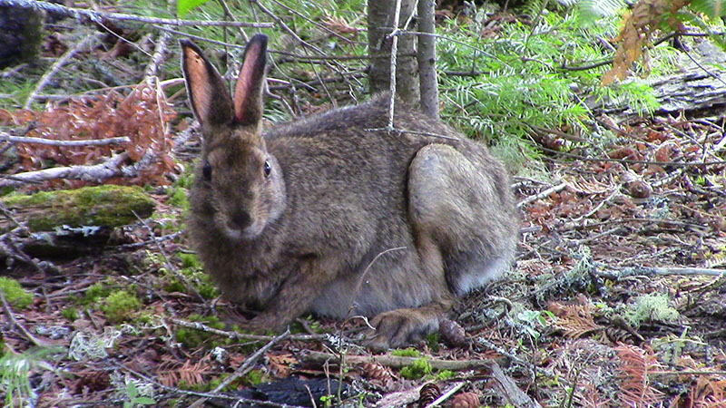
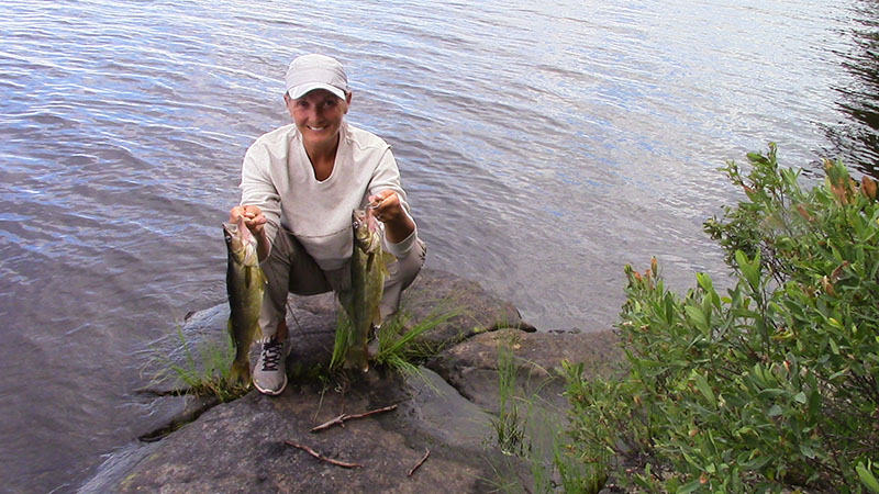
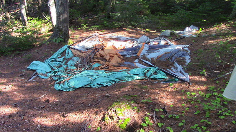
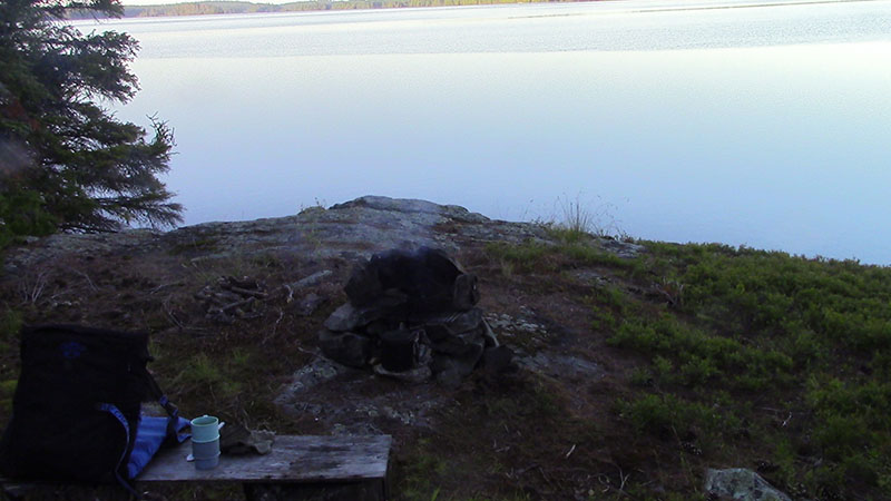
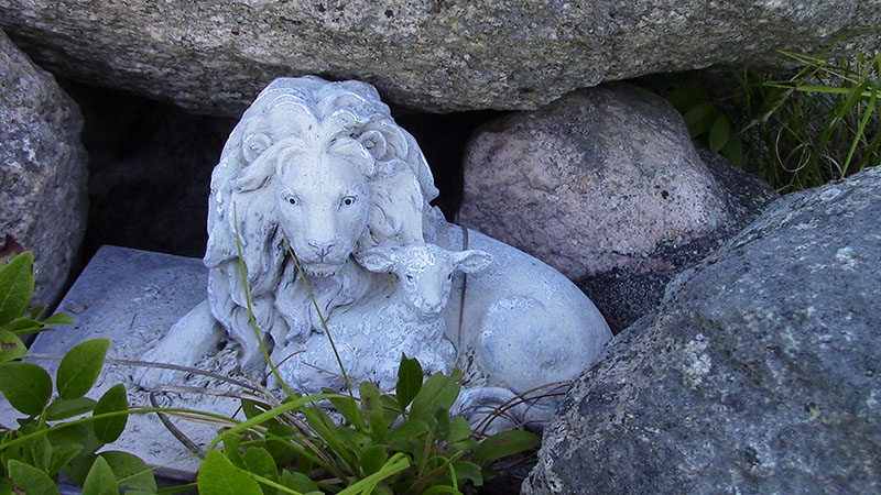
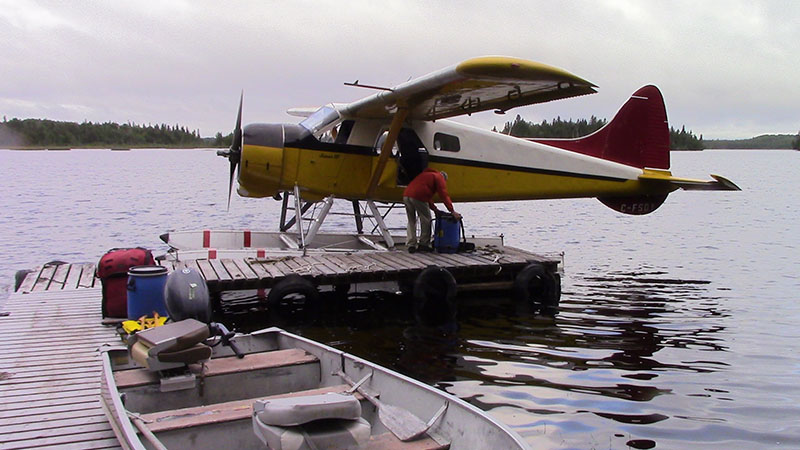
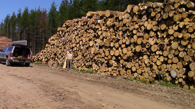
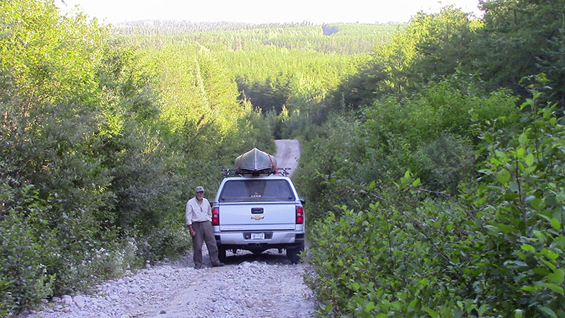
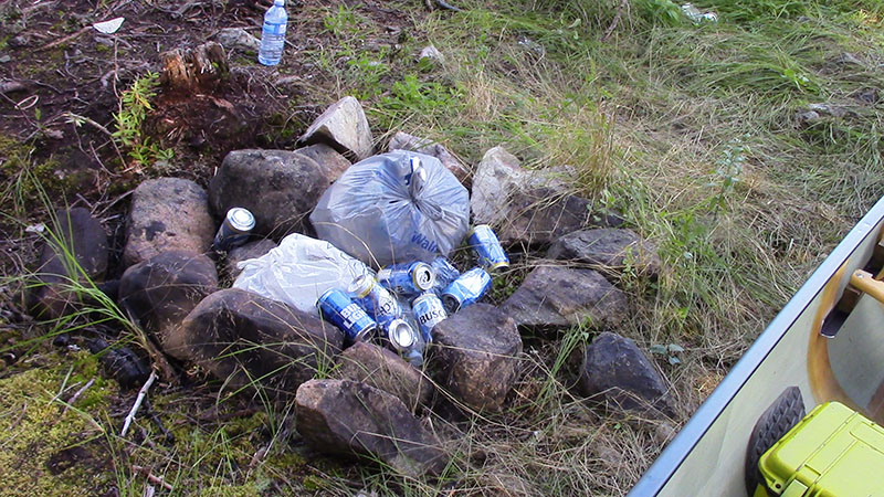
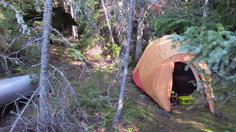
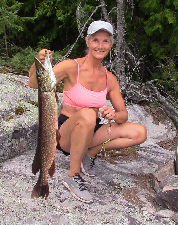
2021 - July 7 to August 24
Anybody here old enough to remember Yogi Berra … that famous Yankee catcher … 18 time all-star … winner of 10 World Series rings?
He was credited with some off the wall sayings like … “When You Come to a Fork in the Road, Take It! .”
My favourite … and the theme of this year’s trip … “It’s Deja vu all over again.”
You may remember that the most remarkable part of our 2020 trip was the lack of people encountered.
For an area that normally has a population of about 16 on any week during July and August we saw a total of 12 people during our 45 days on the water.
The fly-in camps were empty due to covid.
2021 was “Deja vu all over again.”
We left home on July 6 at 10pm intending to spend 9 days on Rush Lake, then 28 days on the Rice Lake area before 14 days on Pebonishewi lake … a total of 52 days.
Arriving at the turn off to the Rush Lake road we were greeted with a sign that prohibited the use of the road to access Rush lake.
This caused a short discussion since we intended to use the road to access Mallard Lake and then paddle through to Rush Lake … a legal point we were ready to argue if necessary.
Indeed, the road had not been used … we had to clear a fallen tree before the turn off to Mallard Lake and the old road to the landing site is closing in … but we made it.
This was the first time since the mid 70’s that I had been on the lake for more than a couple of days without seeing anyone … it was great … reminded us of our 65 day trip where we would go days without seeing a soul.
We have a new campsite on Rush that we built a few years ago and it hasn’t been discovered by the spring fishermen so it’s in good shape … a bit up and down but well protected.
Rush Lake Campsite 1 ...
Rush Lake Campsite 2 ...
Rush Lake view
Caught a few fish but we were prepared with 9 days of food so we ate from our supplies..
We made a trip back to an old campsite that had been so “improved” by the spring fishermen that we didn’t want to use it.
… cleaned it up and took the trash over to the landing and left it behind an outhouse.
Maybe the site will be usable within a few years.
We had arranged to be flown in to Rice Lake so on day 9 we departed … still not having seen a soul … and drove to Marquette Lake to meet our charter.
Remember that I’m 81 this year and although we’ve tried various ways to access Rice Lake I just didn’t want the punishment of hauling gear and food for 42 days over any of the possible routes to Rice Lake.
We checked with three different fly-in services and considered the total cost of driving distance, possible overnight accommodations and flight cost.
The overall winner was Lauzon Airways … their flight cost was less and they were a reasonable driving distance given that we could fly out of Marquette Lake.
So … on July 16 at 6am we arrived at Marquette Lake … by 9am the plane was gassed and loaded and after a short warm-up we were airborne.
The flight north was uneventful and a couple of circles of Rice Lake revealed that neither of the camps there were occupied.
We landed at the north end of Rice Lake … unloaded … and waved goodbye to Ray as he taxied away.
Now just to get our gear and 42 days of food to a campsite where we could cache 28 days of food as well as a barrel of gear resupplies and emergency items.
Fortunately, it was a calm morning and even though we were overloaded … 4 large barrels, one small barrel, Wabakimi pack, fishing gear case and camera case … we still had enough freeboard to make the paddle to our first campsite.
The site required some minor cleanup but we were soon set up with all extra stuff under cover … we’ll find a suitable cache site tomorrow … now’s time for a pot of coffee so we can sit and listen to the sounds of nature.
Once again we’re using our Zoleo device to provide us with weather forecasts so we can plan to paddle on calmer days … and it gives us a texting capability (Bluetooth connection to our cell phone) so that we can check in every third day.
We’ve also brought our satellite phone in case anyone needs to talk with us (text us first and we’ll call you) and as an emergency backup.
By only using the Zoleo every third day it’s charge will easily last for two weeks … and we’ve got a solar panel to charge the Zoleo, the cell phone and the satellite phone.
We’ve established six sites on Rice Lake as well as a site each on Northpoint and Wenakoshi.
Our plan is to move about every third day so we don’t overuse any site and they get to recover before we return.
By planning to use sites in a north south order we can get in some longer paddles to stay in shape and enjoy the beauty of the north.
We’ll be following an intermittent fasting schedule that sees us having only black coffee until our first meal which will be after noon … our second meal will be at about 7pm … there’s also our regular afternoon whiskey and jerky when the day’s tasks are complete.
General rule of thumb is … no breakfast until dinner is on the stringer … with a time limit of 12:30.
July 17 – Day 2 … Cached our extra supplies today.
We brought a chain that we used to attach the barrels to a tree and used a cotter pin to lock the lids.
Fishing is good off this site so we have our first fish dinner and start to plan for our subsequent movements.
We continue our north south movements … cleaning up campsites as we go … and having some great luck fishing.
Rice North 1 ... Rice North 2 ... Rice North 3
Rice Northwest
Mid Lake 1 ...
Mid Lake 2
Rice South East 1 ...
Rice South East 2
Rice Fishing is Good
A few planes fly over but the only one that lands is a guy we’ve come to refer to as “South side Johnny” … he’s a day tripper that always lands in the same place … retrieves a boat … fishes for a few hours and flies out.
Aug 1 – Day 24 … Ivanhoe brought some fishermen into the south camp today … they venture into our section of the lake but don’t come over for a chat.
We’re scheduled to leave the next morning so we never get to meet them.
Aug 14 – Day 37 … Marks the end of our 28 days on Rice Lake … We’ve only seen that one party of fishermen.
We’re nice and tan … the intermittent fasting and living on the ground is working its wonders.
Off to Pebonishewi
Lauzon shows up at 8:30 and the short hop to Pebonishewi gets us there at 9.
Ray is taking our empty food barrels back to Marquette Lake so we don’t have to worry about caching them somewhere.
We paddle to our first site only to find a tree down across the back of the site … a couple of hours of work had the site in shape for habitation for the next few days.
Fishing and swimming are usually great at this site and again it doesn’t disappoint.
We’ve established five sites on Pebonishewi so with 14 days left it might mean only a couple of days on each site.
Pebonishewi North 1 ... Pebonishewi North 2 ...
Pebonishewi East 1 ...
Pebonishewi East 2 ...
Pebonishewi Catch ...
BUT WAIT … Ivanhoe flies into the north camp and drops off a party of three … guess we’re not going to have the lake to ourselves.
We see these guys a couple of times … they stop once to say hello … we move to another site and never see them again.
Aug 15 – Day 38 … Ivanhoe brings another party into the south camp.
We’re camped at the north end of the lake so they come over for a visit … It’s Fred and his nephew Zach … they’re from Ohio and they recognize Kathy from our web site.
They’ve been here before as a party of 10 and saw us two years ago.
We remember the party … It’s the guys that were trying to catch 100 fish in a day … and doing quite well.
These guys fish from morning till night … almost all catch and release … they visit several times during their week.
Aug 16 – Day 39 … Gosh, only 11 days left.
We paddled to a mid-lake site we’d setup a couple of years ago and spent some time preparing it for occupancy.
When we stayed here before it proved to be too exposed so we adjusted the tent site and moved the tarp area so it could be better protected.
Back at our campsite Kathy catches the biggest pike we’ve seen here … too big so it gets released.
Aug 16 – Day 40 … Moved to the south campsite and began the resurrection tasks … the guys that stayed here last year manicured the place with a chainsaw.
The firepit was five feet across and the fires they built were so hot that the big boulder that I’d built my cooking area against was split.
All the dead trees at the back of the site were cut down and used for firewood and the site is now so open that the wind from the west is a problem.
The fishing here is still good though … there’s a rockpile in the bay here that attracts lots of good sized bass so we fish it and a nearby island and soon have our choice of bass and walleye for dinner.
We had planned to go down to Owatawetness to see if the ATV trail was still passable but we never heard any boats so we assumed that the trail was now unpassable.
Aug 19 – Day 42 … Moved to an island campsite we’d built our first year here.
It’s a well protected site and the fishing from shore is good but we don’t get morning sun unless we go to the east side … so we’ve built a trail.
Swimming is also a problem since good spots are very steep … making the exit from the water difficult.
Bass fishing is good off the north side of the island but the walleye are few … time to move to the west side.
Aug 22 – Day 45 … Sunday … Fred and Zach leaving today … we wave at the plane as they depart.
The wind dies around noon so we head for the campsite on the west shore that we had prepared earlier.
After camp setup we start to fish and in no time we have a dinner sized walleye but its hot so we decide to forego that fish dinner.
We take advantage of the morning sun with our morning coffee as we discuss our last days and plans to depart.
We need to get closer to the north end so that we’re ready for pickup on the 27th.
Aug 25 – Day 48 … Move to the north … we really love this site … its got a lot of fairly flat rock out in front … great sun exposure all day.
Rain in the forecast on pickup day so we call Lauzon to verify and they are concerned since thunderstorms are predicted on their end so we agree to get picked up a day early.
Its hot and sunny … fish not biting but who cares … sun bathing and swimming occupy our day.
We’re up early on pickup day … break camp … coffee and muffin for an early breakfast … load up and paddle to the north camp where we’ve arranged to get picked up.
Unload the canoe … get all our gear on the dock ready for pickup and walk up to the cabin to wait.
Ivanhoe has really improved the camp since we first saw it in 2015.
Ray has the plane at the dock by 9 and in no time we’re loaded and winging our way south.
We get a birds eye view of the sprawling mine that’s First Gold.
Back at Marquette Lake … pack up the truck … say our goodbyes … see you next year … we’re off to Cartier and our favourite eatery … the Pine Grove.
They know us at the Pine Grove so the discussion soon turns to our 50 days on the water.
Some of the other patrons are also interested so we regale them with our story over a liver and onion dinner.
We don’t want to get to Toronto too early so we usually plan to leave Sudbury around 7pm … this gives us lots of time in Cartier and a stop in Sudbury to refill our coffee mugs.
2022 planning is in the works … stay tuned.
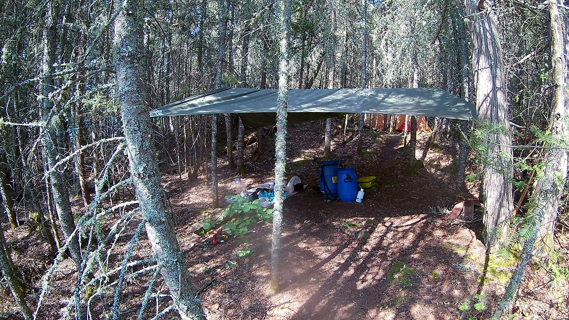
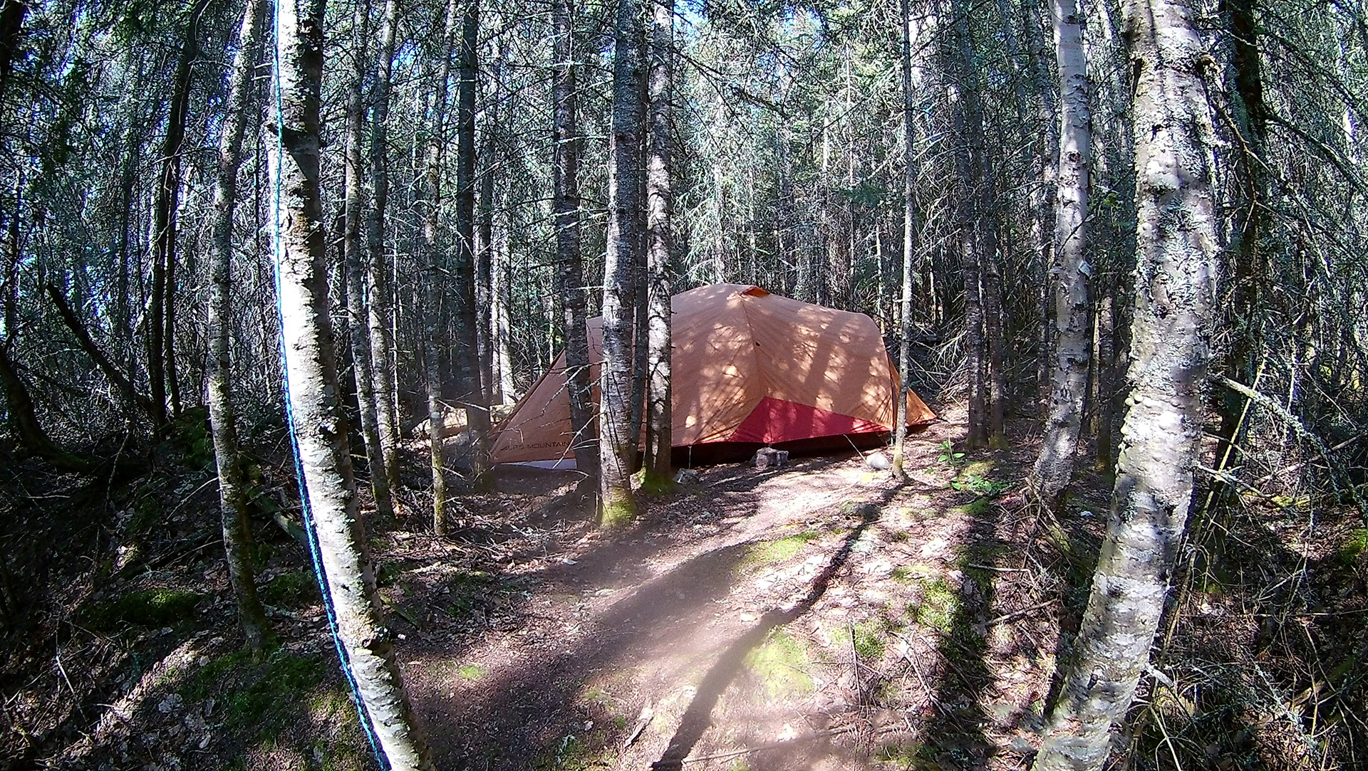
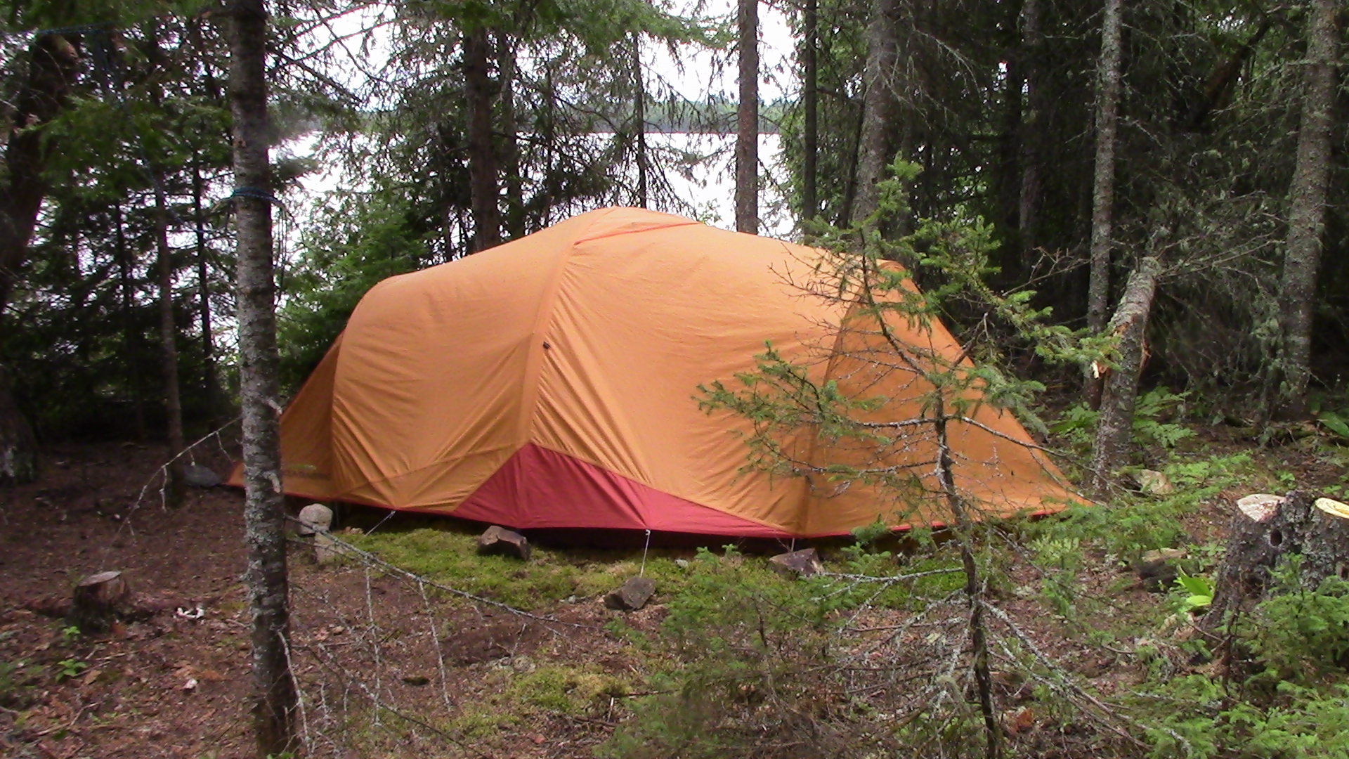
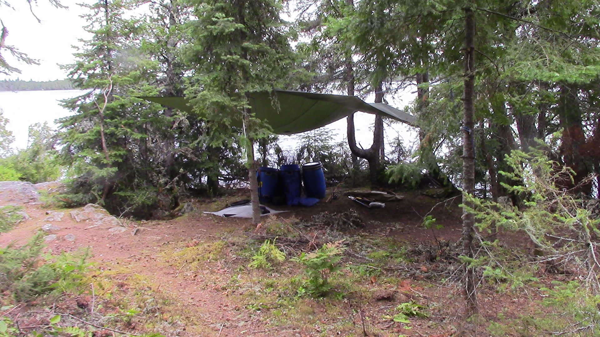
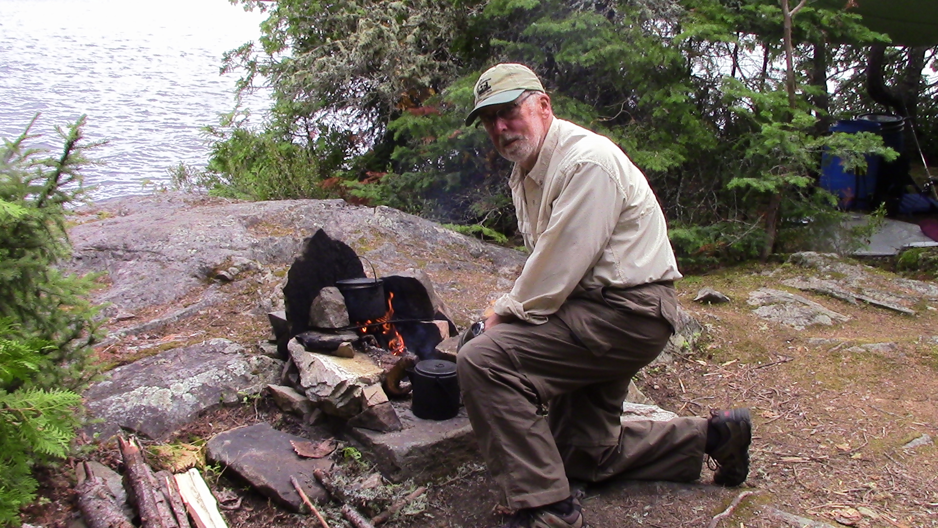
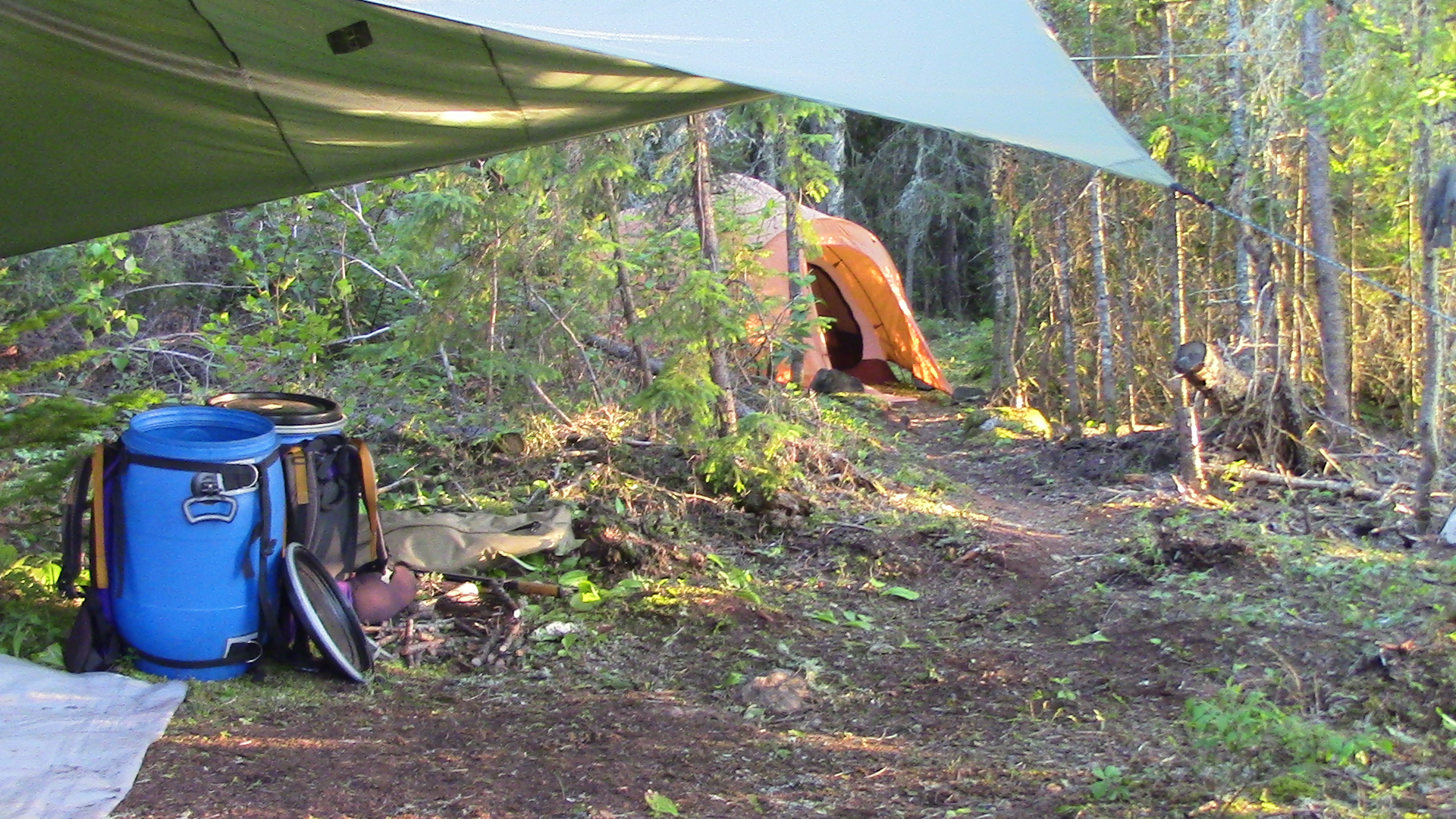
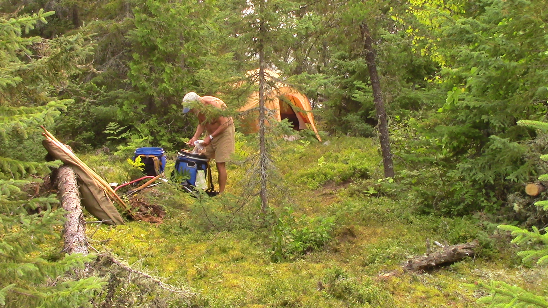
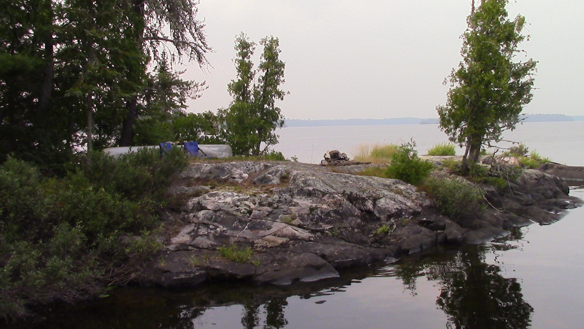
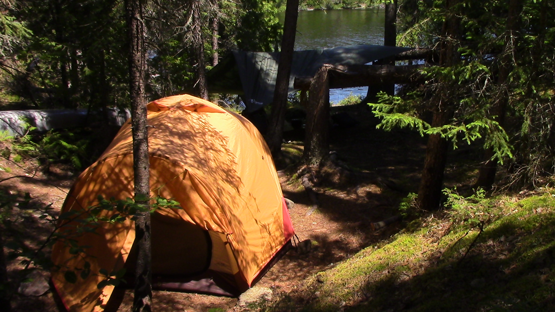
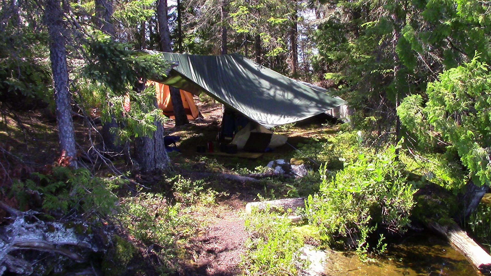
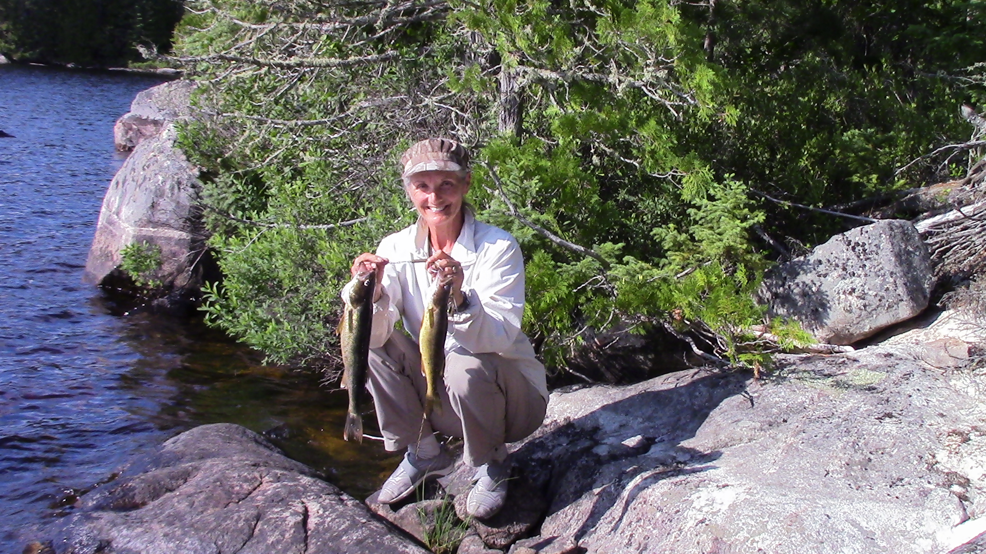
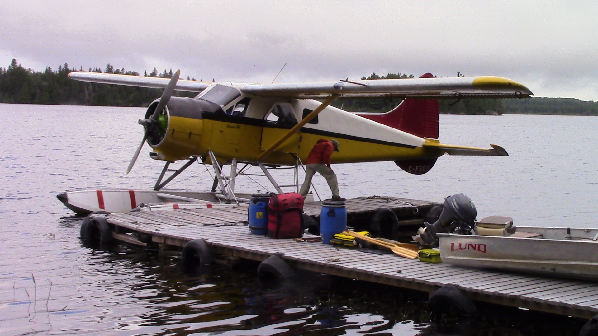
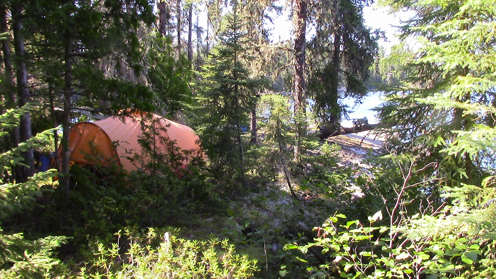
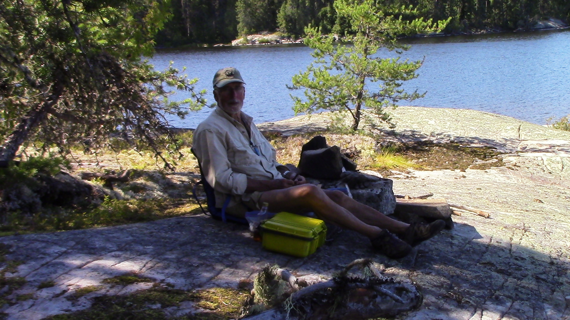
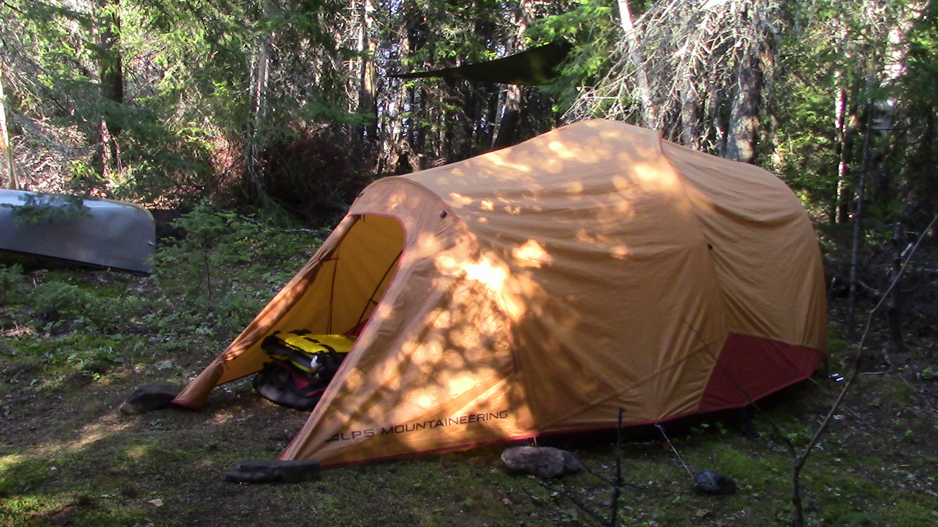
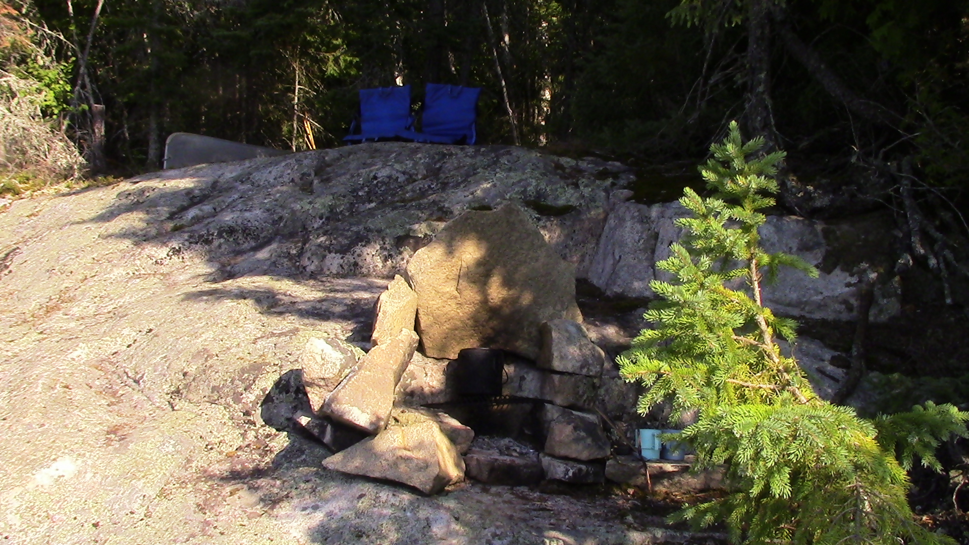
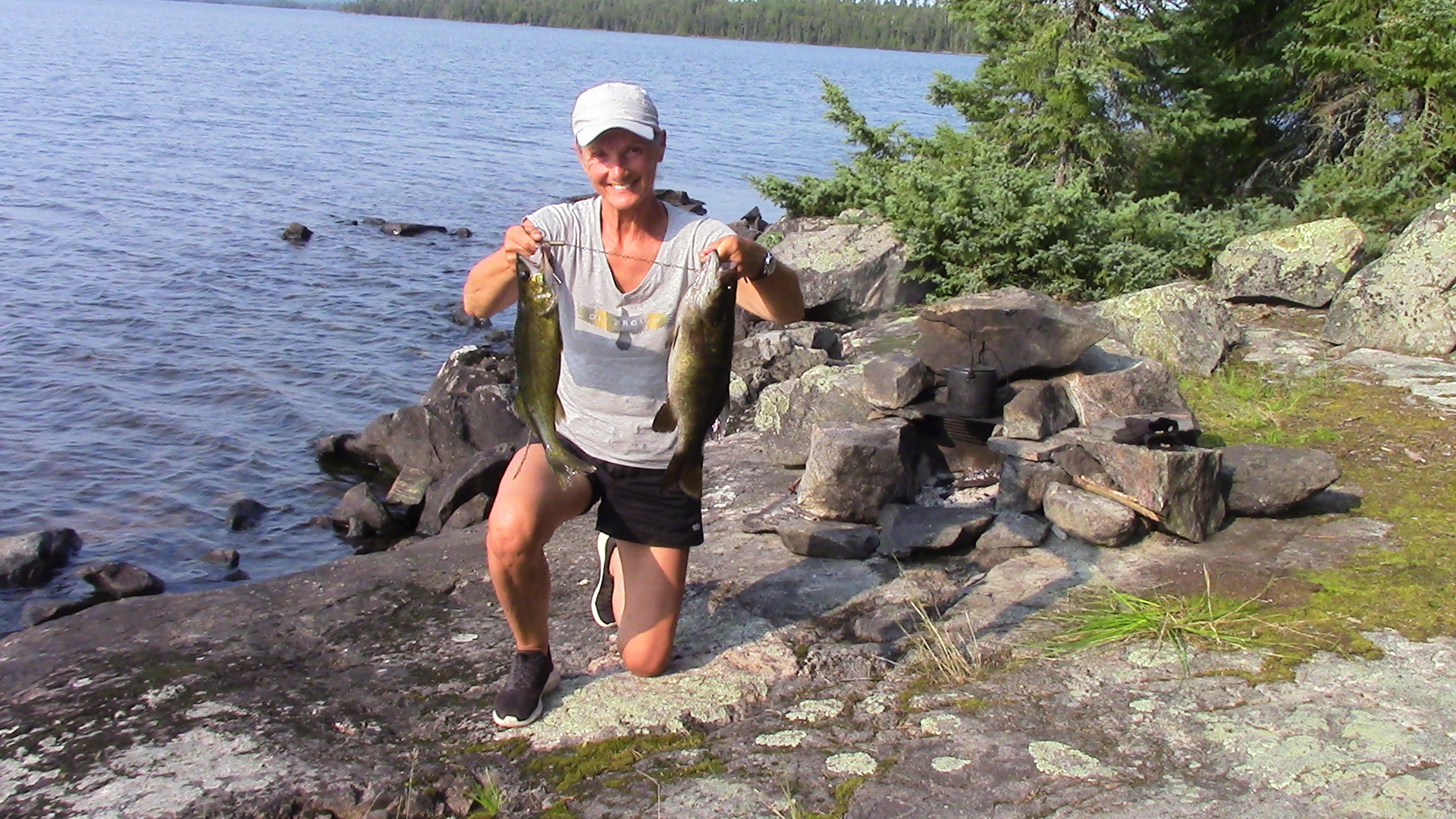
© 2020 canoecouple.com All Rights Reserved.