Other Routes
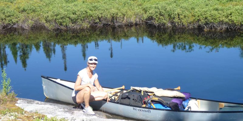
Once you're on the water you'll be by yourself

To get a sense of some of the possibilities in the area just take a look at a topographic map and trace some of the roads that branch off from the Sultan Road.
There are almost endless opportunities ... but here are some of the places we've visited.
Dividing Lake
About 3 km north of the Sultan Road on Highway 144 you'll find access to Dividing Lake. From here some upstream work on the Mollie River will get you to Three Ducks, Weeduck, Bagsverd and Schist Lakes. It's also possible to travel further and reach Schou Lake and descend the Somme River to Wolf and Somme Lakes. There's now an easy connection to Neville and Mesomikenda Lake where you can turn south and work your way back to Dividing Lake.
If you read the fishing magazines in the late 70's it was these lakes that were touted as the best walleye fishing spots ... specifically, Bagsverd and Wolf Lakes.
The Chester Road
Turning west on the Sultan Road you'll encounter the Chester Road at the 3 km mark.
Turning north will yield access to Chester Lake and you'll cross the stream that connects Schist and Bagsverd Lakes. Further north is the bridge over the Somme river between Somme and Neville Lakes. You may find people camped at the access points but if you paddle and portage one lake away you'll find that you're alone.
On our first trip to Schist Lake Kathy caught a pike that was so big that we didn't even try to get it into the canoe ... it was longer than the width of our canoe.
New Arbutus Road
Further along the Sultan Road at the 24 km mark the New Arbutus Road leads north and enables access to Stony and Arbutus Lakes
Access to these lakes is at the bridge spanning the outlet of Stony Lake. Just across the bridge on the right is a campsite and parking place used to launch into Stony Lake ... again, you may find someone camped here.
The road used to be open as far as Windy Lake but it's long since closed in.
Once you access Arbutus Lake it's an easy trip north to the east arm of Opeepeesway Lake and straight across you'll find the outflow of Little Rice Lake.
Mallard Road
At about the 46 km mark on the Sultan Road is the right turn that will lead to the bridge over the Opeepeesway River.
You'll almost always find someone camped here since there are a lot of people who fish these waters on a regular basis.
Early in the year this place ... and all the islands on Opeepeesway will be occupied by fishermen ... but as the season progresses just the access point will have occupants ... however, the islands will be a bit of a mess.
As a canoer you'll be able to find camping spots that the boaters can't use.
If you cross the bridge and continue for about 7 km you'll find the portage leading to Rae Lake. As you drive look for the red flagging tape on the north (left) side of the road.
This is the extention of the portage from Opeepeesway to Rae Lakes ... it's almost all downhill to Rae Lake and there's a nice launching point.
We just completed the clearing of this portage in August 2010 so I don't imagine it's been used at all ... the access here has been lost for so many years that the fishing here should be quite good.
Paddling north on Rae you'll encounter large marshes with a small navigable stream as you pass through Mallard and Marion Lakes ... the waterway widens as you approach Rush Lake.
Rush Lake used to be home to some monster pike but the fishery declined when the road to the southwest corner of the lake was discovered. Now that the road is almost impassable the fishery is coming back ... and where once there were almost no walleye now there are reports that some decent fish are being caught. That's according to the fly-in guys we meet there.
Rice Lake
Whenever we're in the area we're constantly stopped on the lakes by guys that have driven in to ask ... "How can I get to Rice Lake?"
The word in the fishing community is that the fishing on Rice Lake is such that guys will do almost anything to get there ... except of course pay to have the fly-in operator take them there.
At this point there are only three legal and passable paths to Rice Lake.
The first is up the Rice River from Rush Lake. It can only be done by canoe since the portages are too narrow for a boat and the river is too shallow in places for a motor. However, if you are willing to put in the labour to get yourselves there it'll take about 6 hours to do the distance which will include five portages.
The second is through the north end of Little Rice where you'll portage into an unnamed lake and then east to Rice.
The third is out the east side of Little Rice to a gravel pit and then a 3.5km hike up a road to an ATV trail that leads to Rice Lake.
We've been to Rice Lake numerous times ... we always catch our share of walleye - and lately some smallmouth bass ... so don't worry about having a few fish dinners.
We just love it when the fly-in guys there approach us and ask ... "How did you guys get here?". We produce our maps and trace the multi-day path for them. At that point they decide they'd rather pay to fly in.
© 2020 canoecouple.com All Rights Reserved.